This post may contain affiliate links. Please read our Disclosure for more info.
**UPDATED** We’ve updated this post to include our 2019 presentation (below). We’ve added a lot more information and images to this year’s presentation as opposed to the previous versions. You can download the updated presentation below.
We’ve been asked if our TrawlerFest presentation, Cruising to the Dry Tortugas, will be posted on our blog and so I thought I would share it with you along with the map handout and some resources we shared. Below is a link for a PDF of the presentation. We did show a few short videos in the presentation which I had to take out to make the file size smaller on the PDF. Most of the videos are ones I’ve posted before on this blog and you can view all of our videos on our Youtube page.

Download Cruising to the Dry Tortugas
Resources and Links
- Tortugas Bound! Exploring Florida’s last piece of wilderness (PassageMaker Article by Kim Kalisik)
- Overall Map of Dry Tortugas (with our added spots)
- Dry Tortugas – National Park Service (website)
- Boat Permits & Mooring Buoys – coordinates for mooring buoys
- Downloadable brochures (National Park Service website)
- Osprey Kite to ward off sooty terns (Amazon link)
- “Fort Jefferson and the Dry Tortugas National Park” book by L. Wayne Landrum (Amazon link)
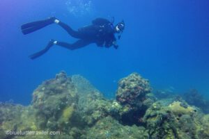
Dry Tortugas Dive/Snorkel Moorings:
- Windjammer – N24°37.413 W082°56.548
- The Maze – N24°36.600 W082°56.914
- Davis Rock – N24°41.209 W082°54.440
- Texas Rock – N24°40.082 W082°53.125
- Off Ramp – N24°40.156 W082°54.506
- Loggerhead SE – N24°37.833 W082°55.187
- Loggerhead SW – N24°37.8031 W082°55.546
We hope you enjoy the above presentation and resource links. Please let us know if you have any questions about cruising to the Dry Tortugas.
What a great write-up! You’ve definitely put the Dry Tortugas on our list of dream destinations.
Definitely check it out! You’ll love the Dry Tortugas!