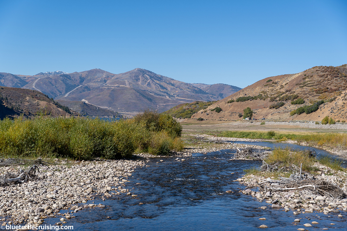
After we wrapped up our 2025 summer work camp season in the Black Hills, South Dakota, it was early October. We planned to head East back to Florida for the winter, but first wanted to explore a few parks out west. When we left the Black Hills, we first headed west across Wyoming and then south into Utah. We stopped and stayed at Jordanelle State Park near Salt Lake City for a few nights before heading on to Bryce Canyon National Park.
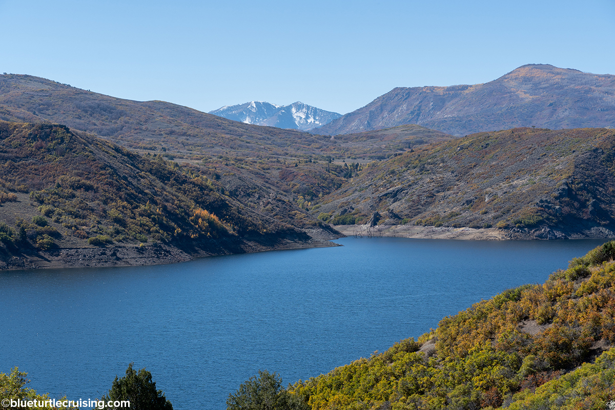
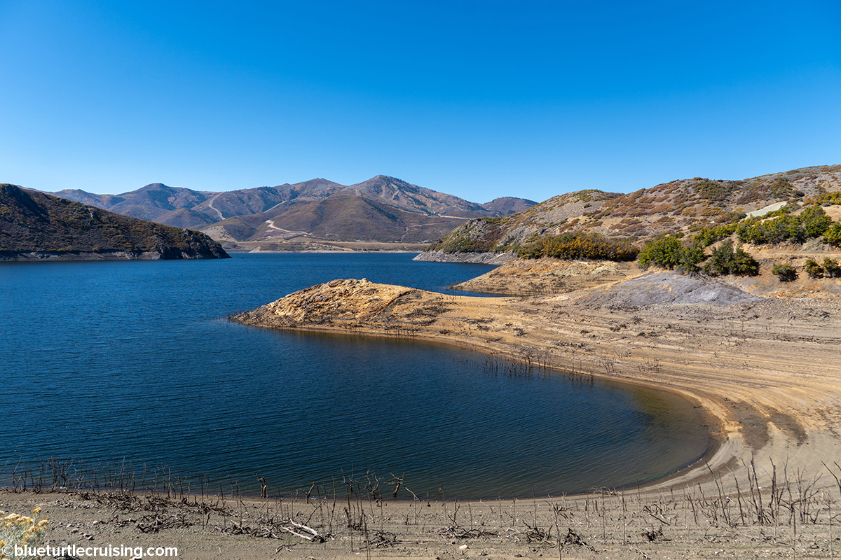
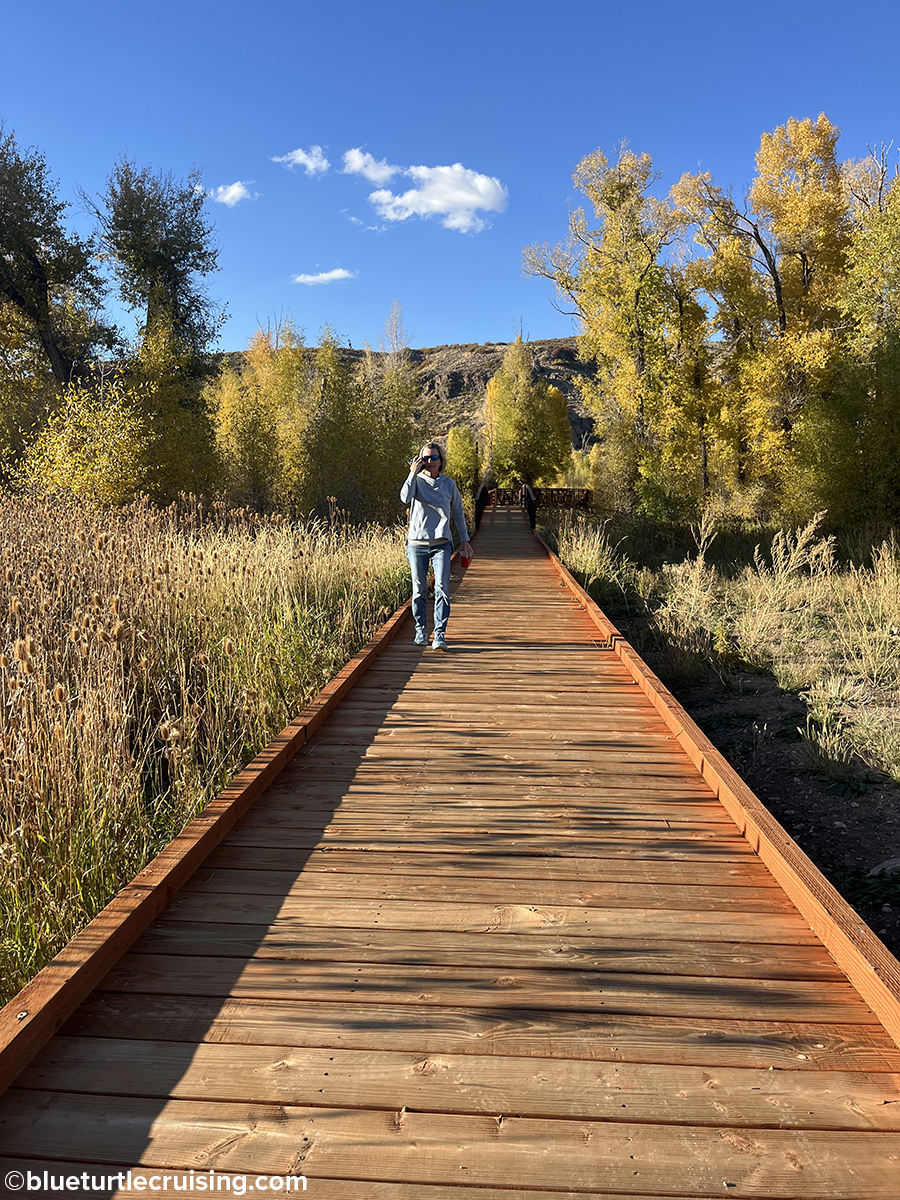
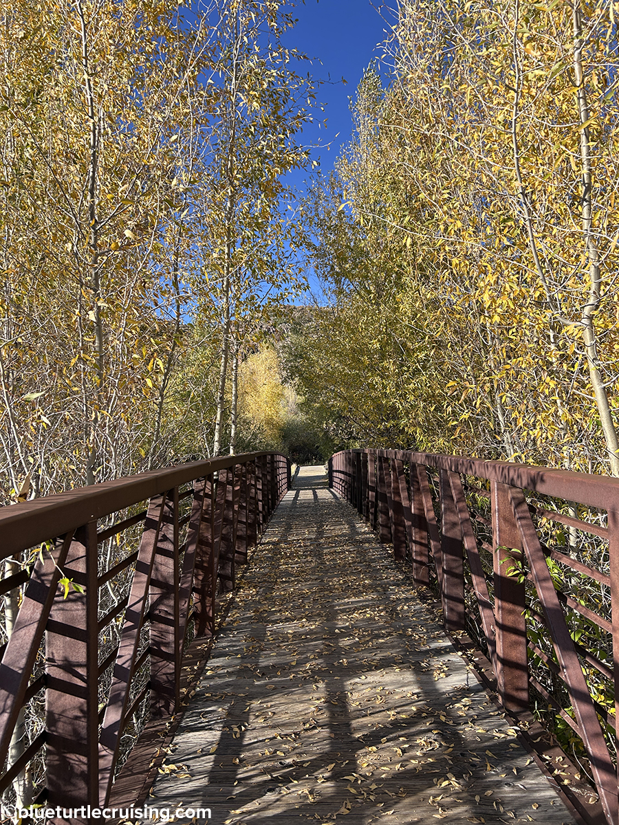
Jordanelle State Park
Jordanelle State Park was absolutely gorgeous with views of snow capped mountains and surrounded by the waters of the Jordanelle Reservoir. We loved that right off the camping area you could pick up the park’s 30 mile Perimeter Trail. This trail takes you around the reservoir and is popular with hikers and mountain bikers. We hiked some of the trail and enjoyed the different views of the water and mountains.
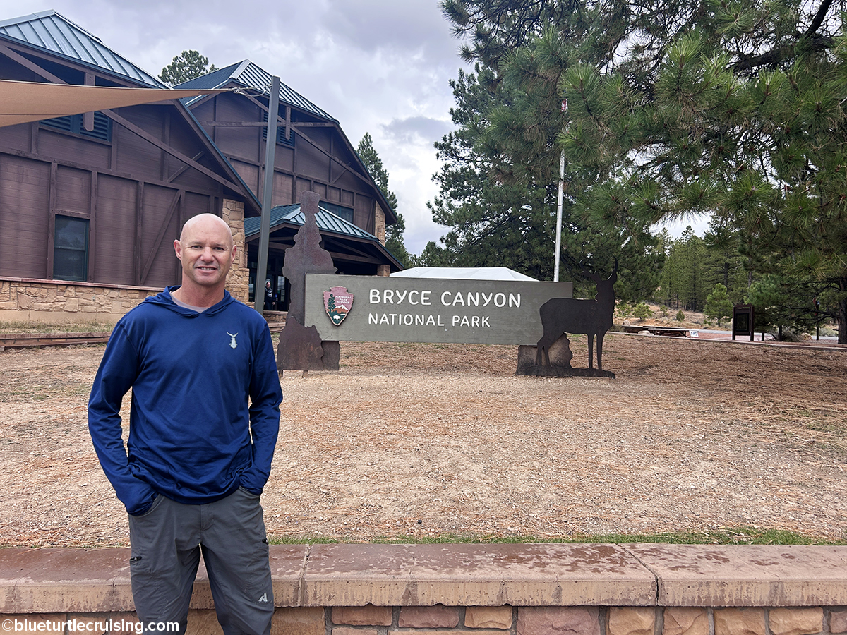
Bryce Canyon National Park
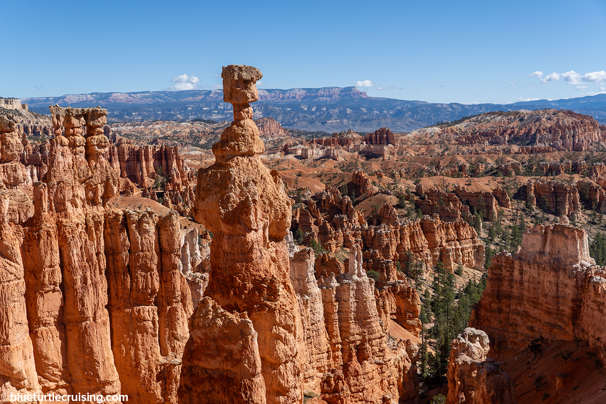
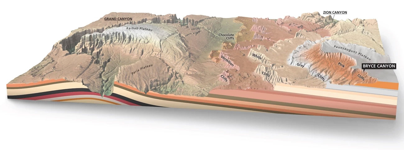
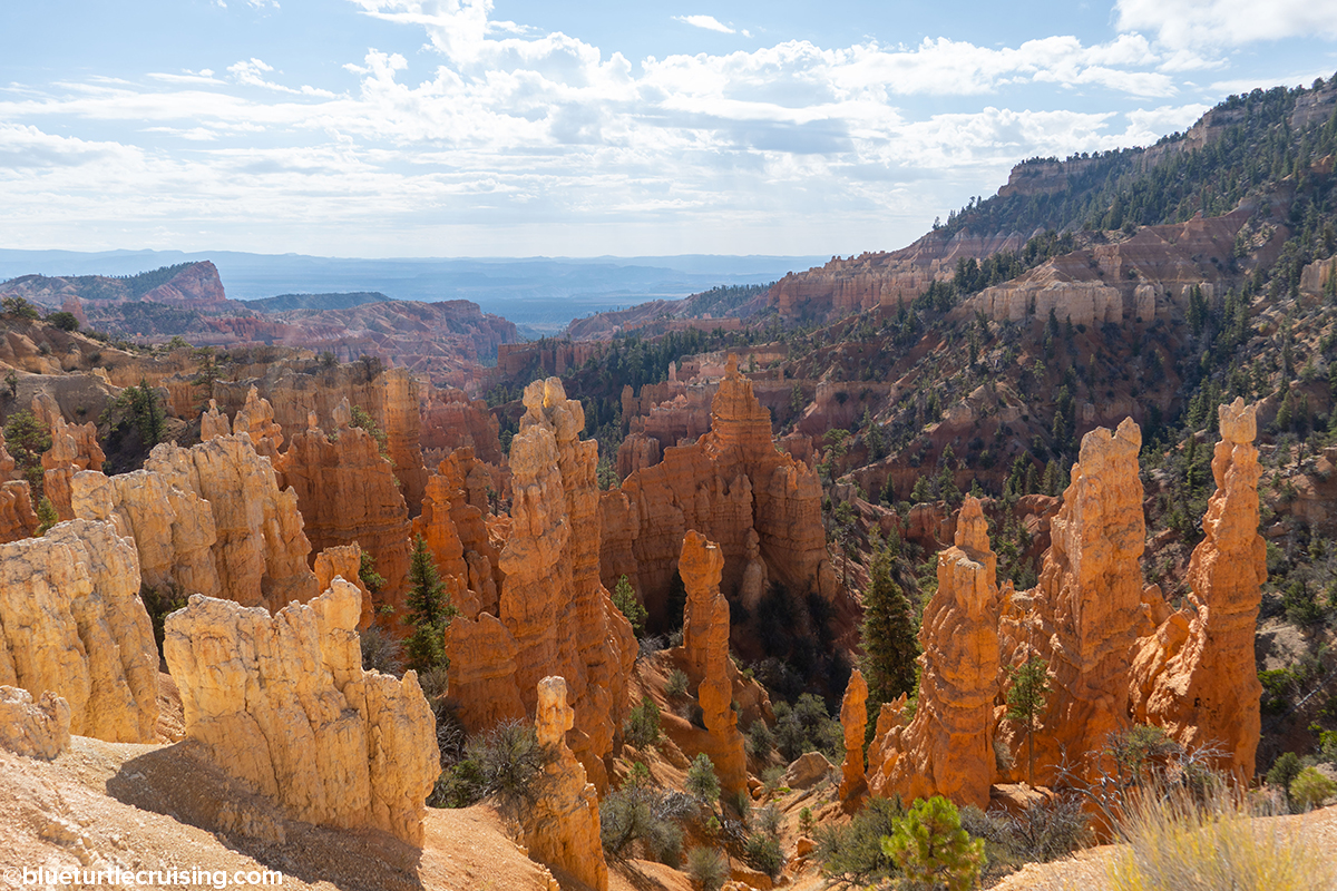
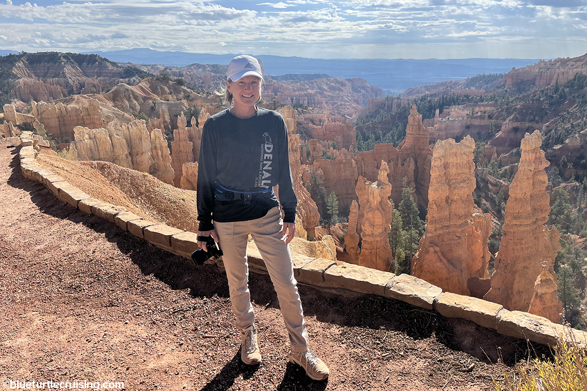
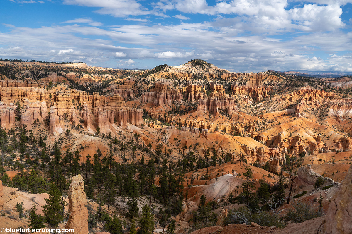
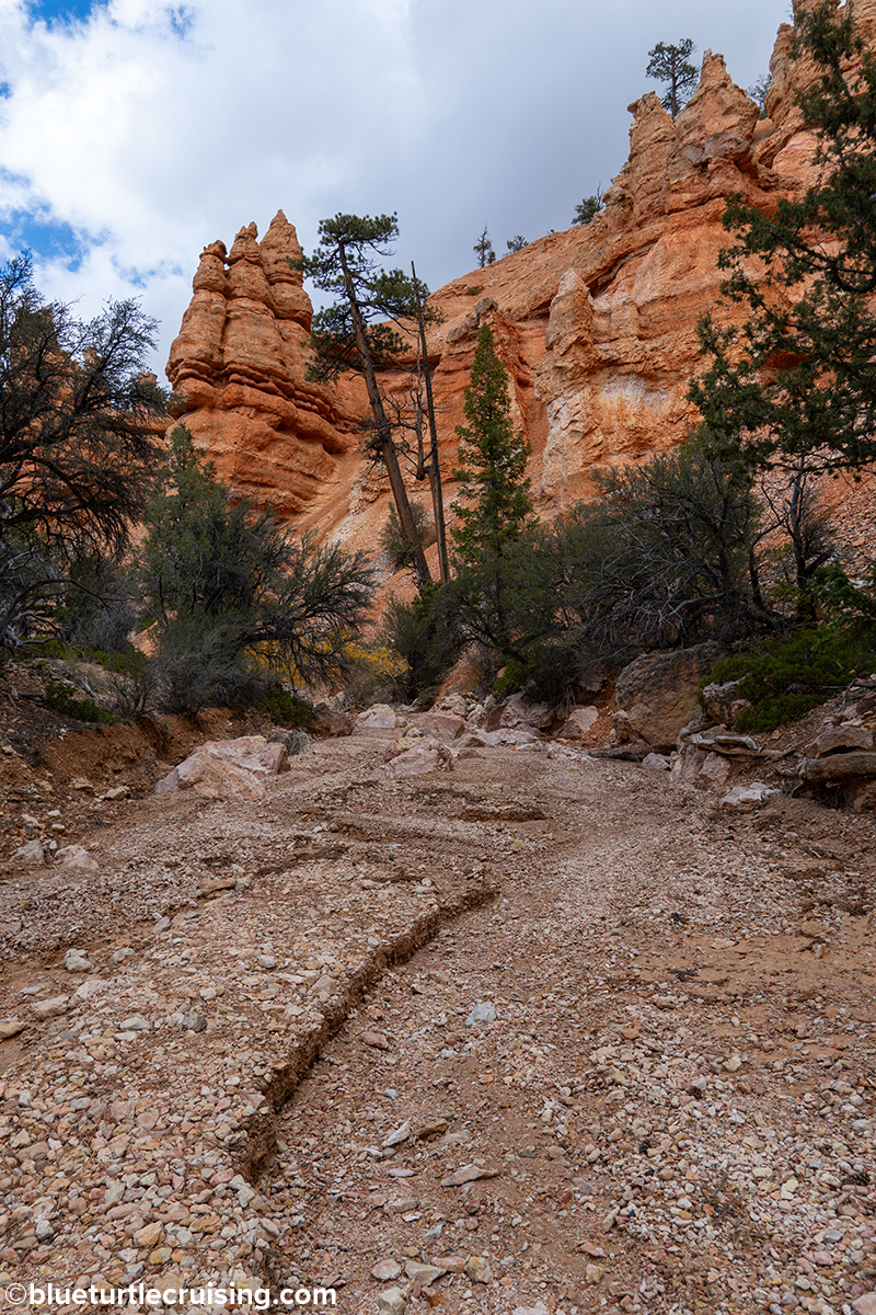
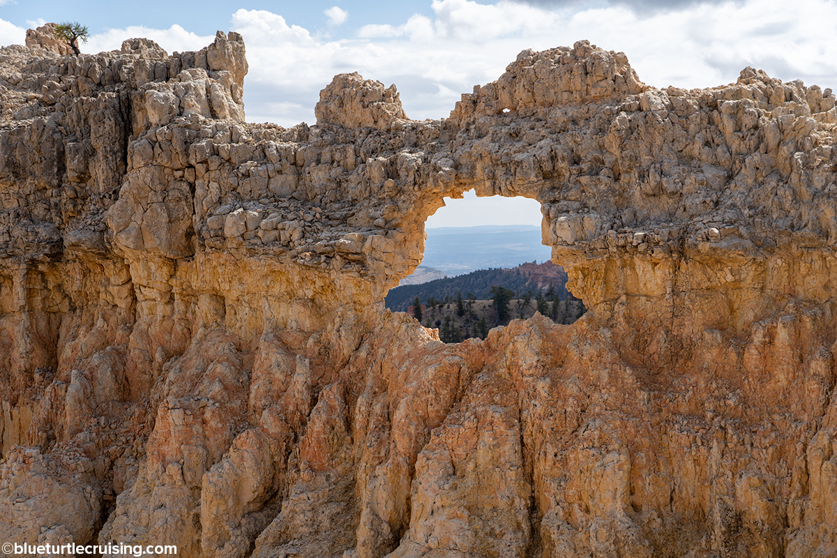
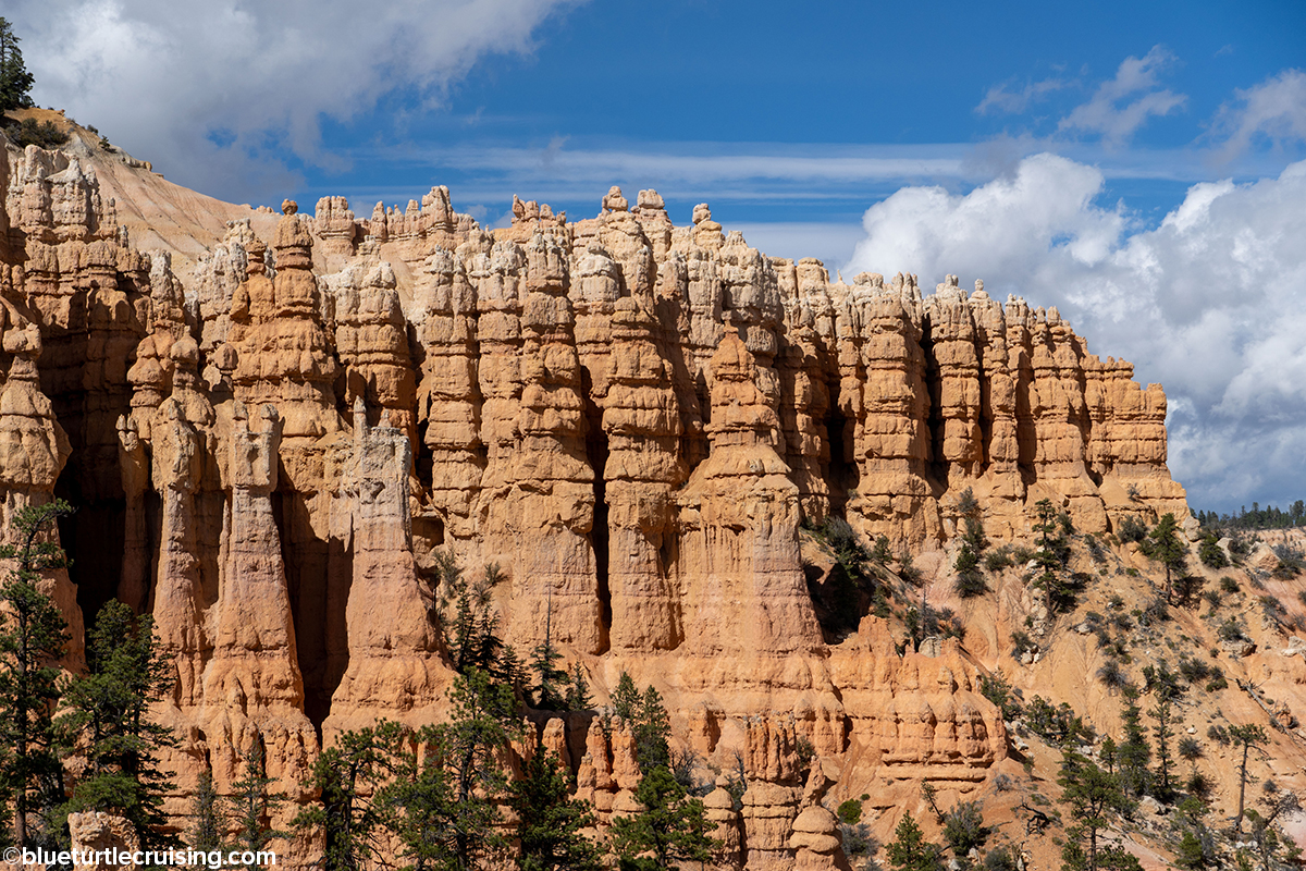
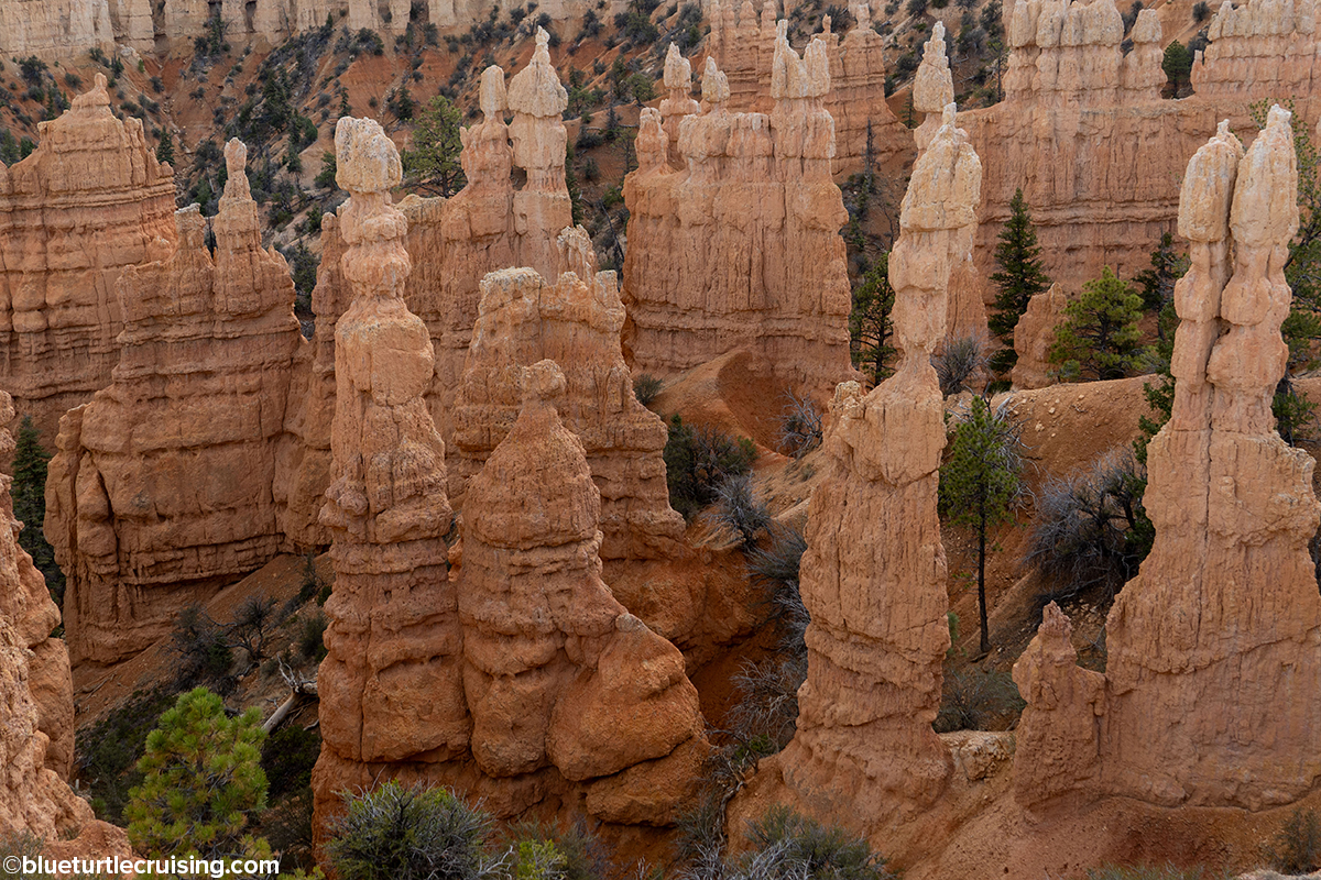
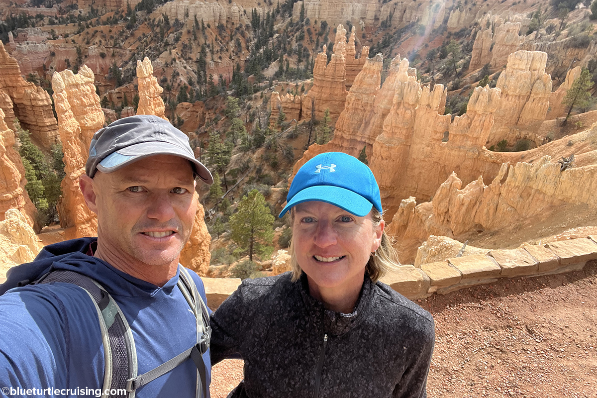
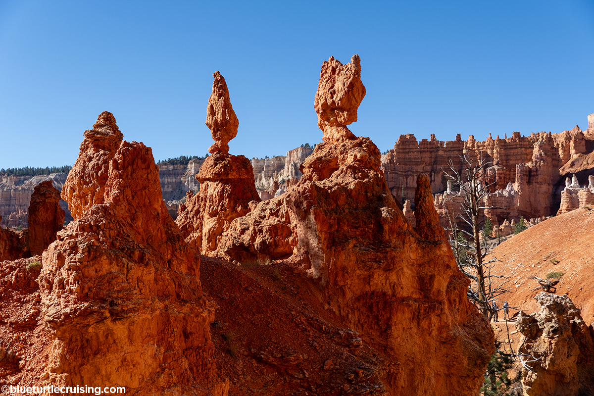
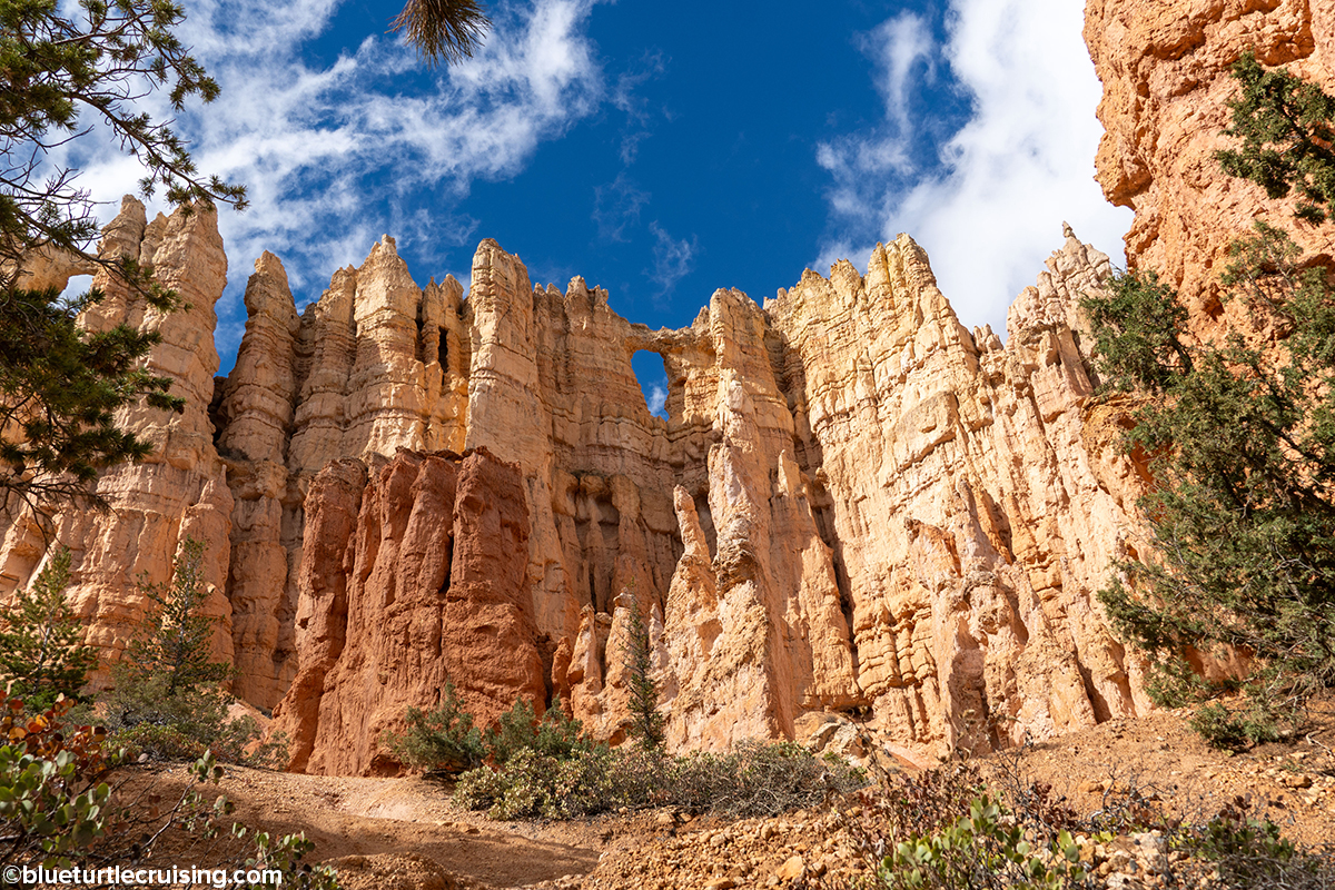
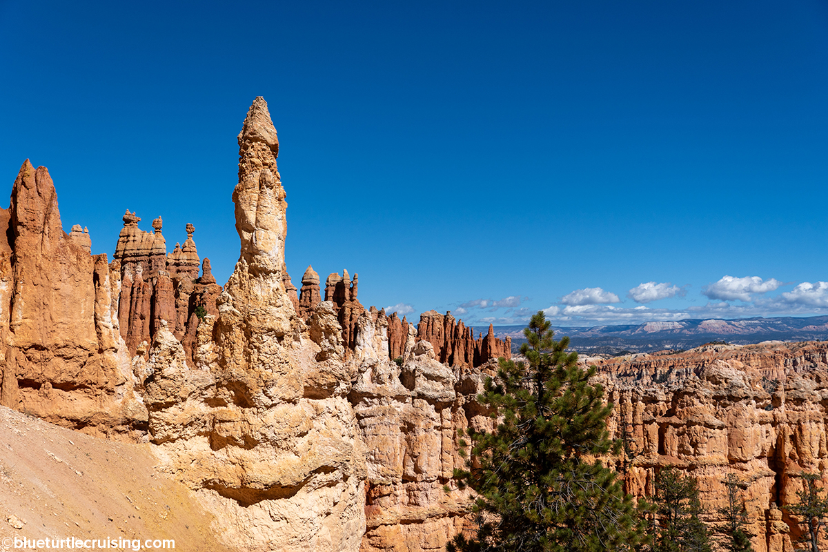
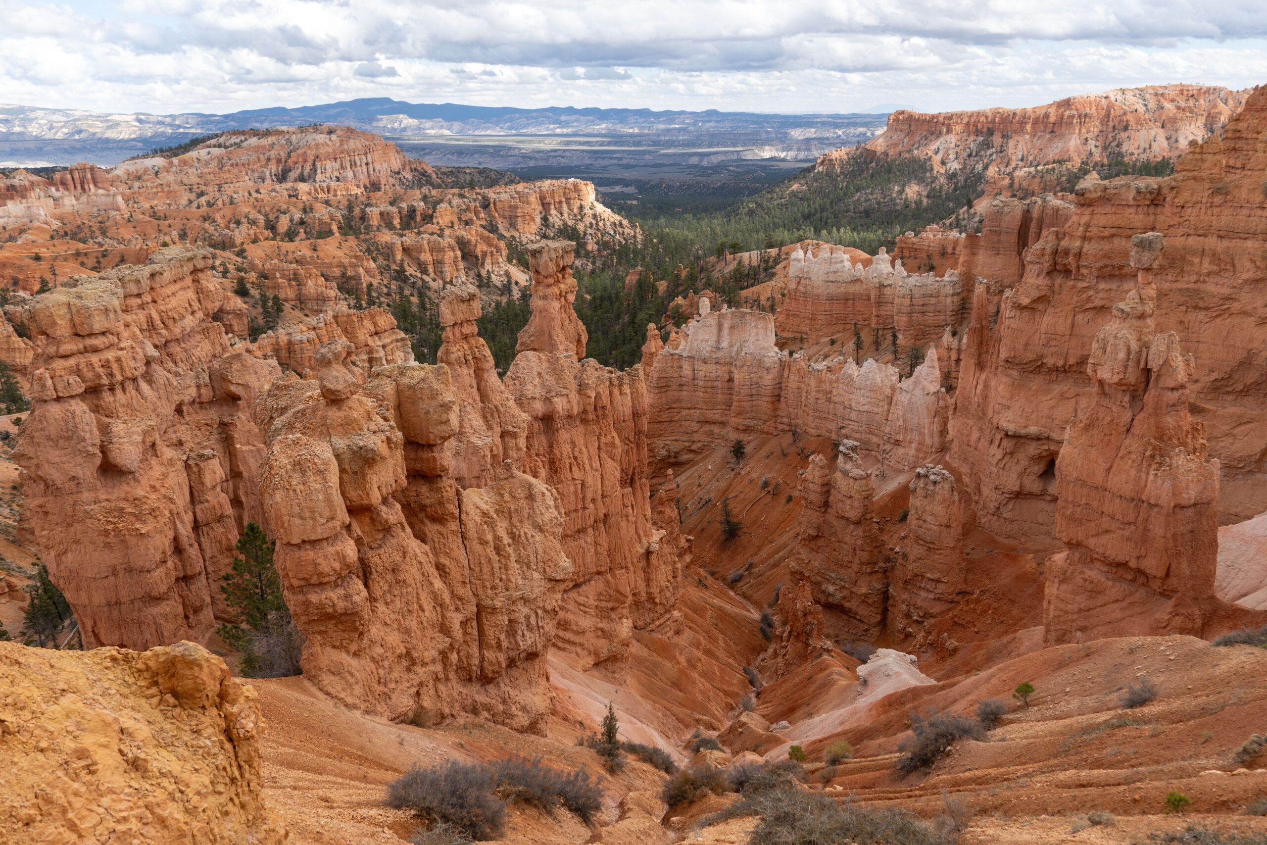
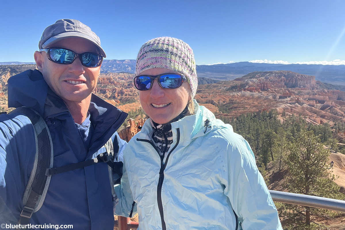
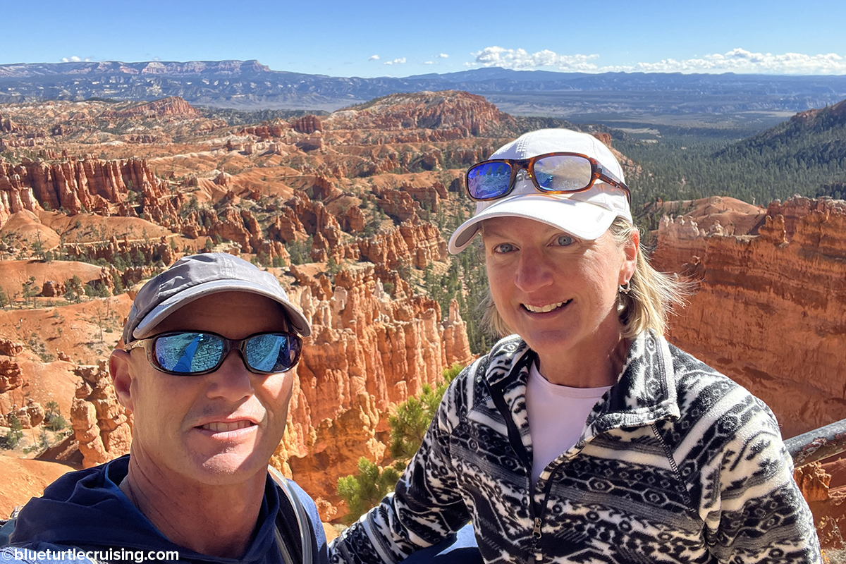
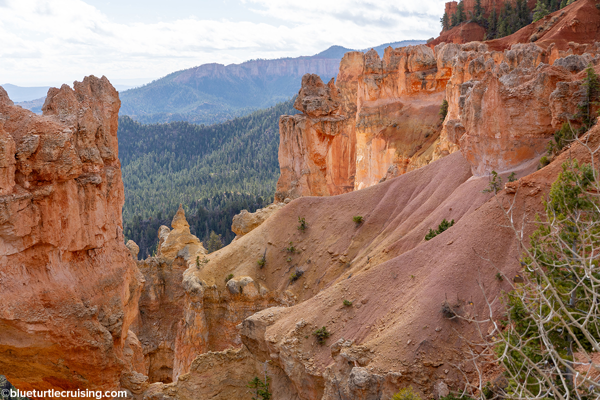
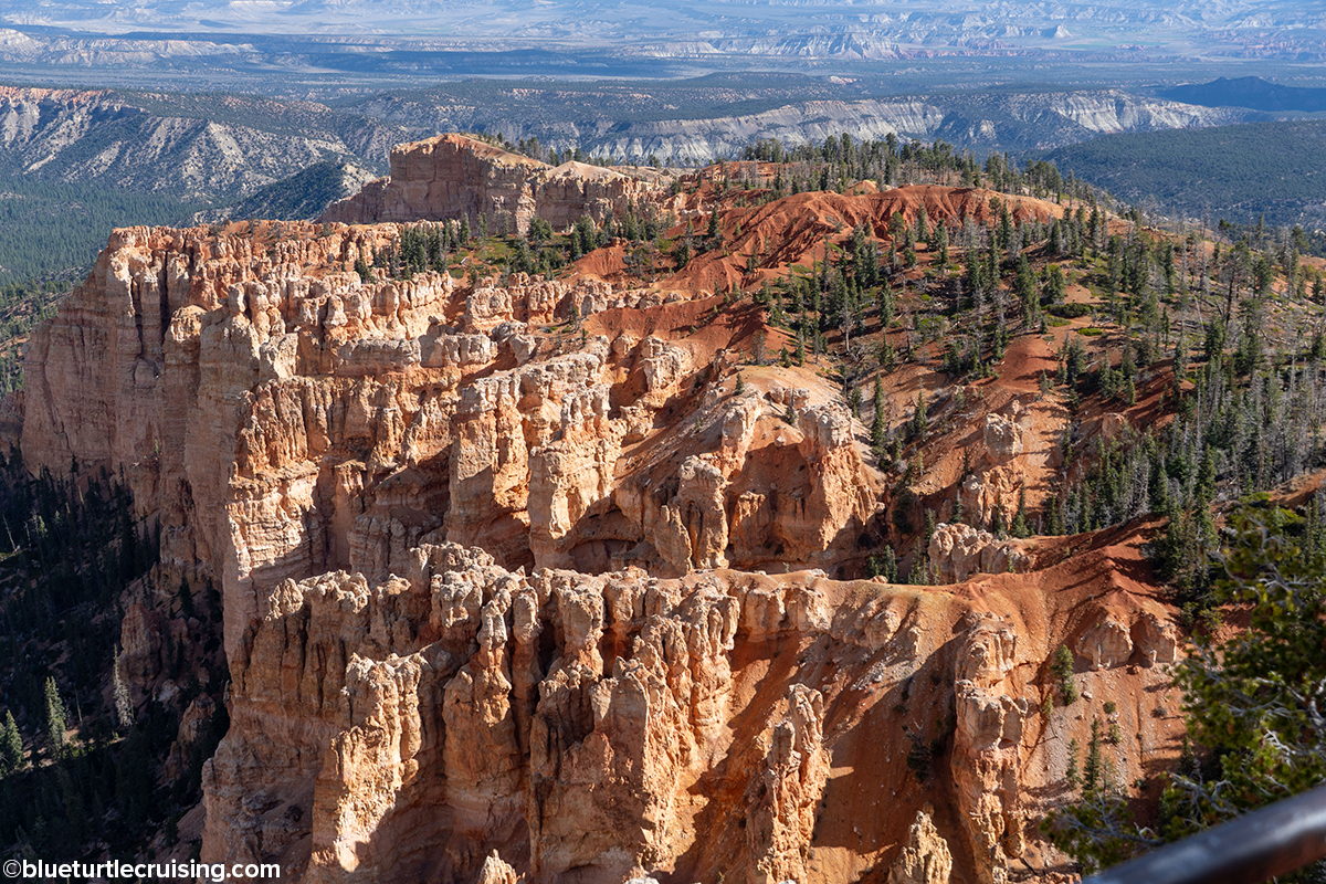
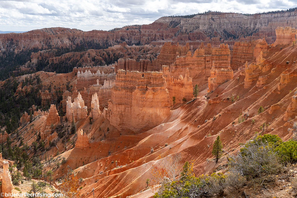
Bryce Canyon, known for the spire-shaped rock formations called hoodoos, is located at the top of the Grand Staircase which is and immense sequence of sedimentary rock layers that stretch south for 100 miles through Zion and into the Grand Canyon. The park’s main road leads past the expansive Bryce Amphitheater, a hoodoo-filled depression lying below the Rim Trail hiking path that has various overlooks and view points. It is absolutely jaw-dropping to see it.
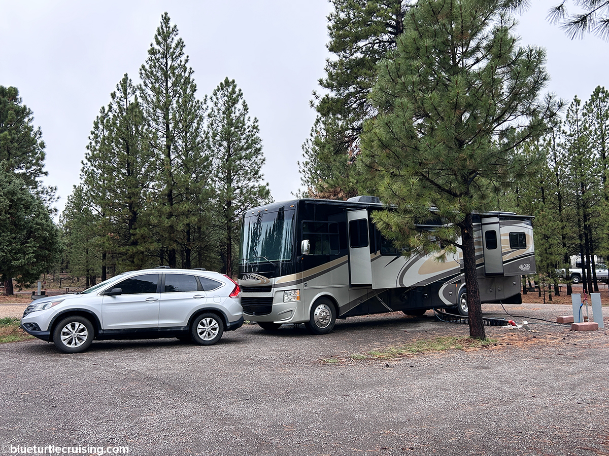
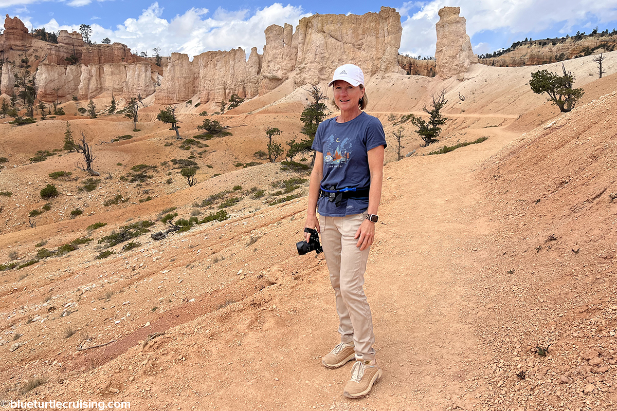
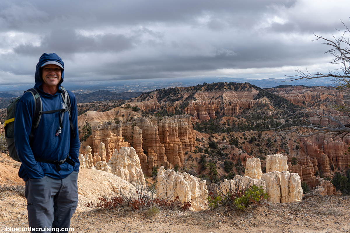
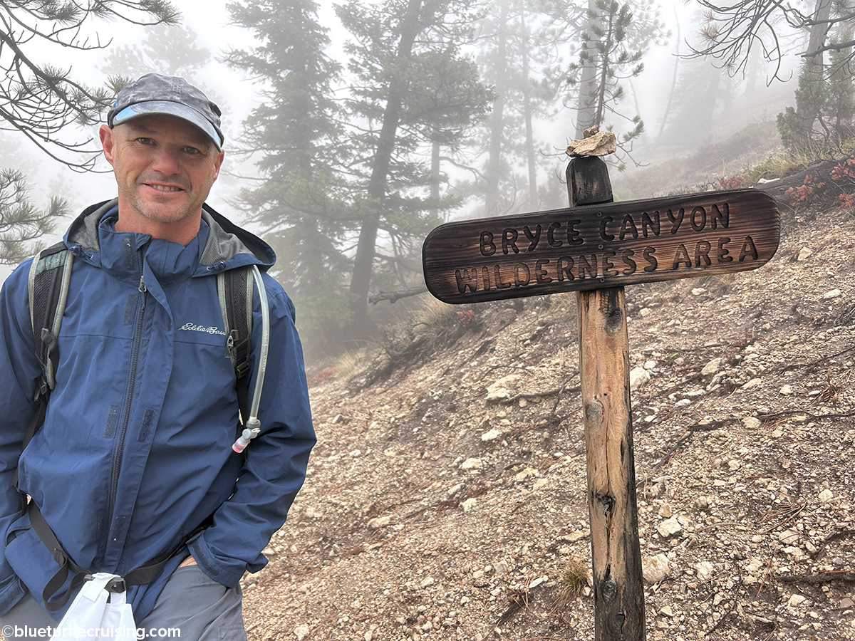
When we were looking to visit Bryce Canyon National Park, we wanted to stay within the park but since we only booked a couple weeks in advance it wasn’t possible. We were, however, able to book a week at Bryce Pines Campground which was nothing fancy but was located less than 10 minutes from the park’s entrance. The weather didn’t cooperate much with us at first with a few cold, rainy days but we were still able to get out each day (except one) and hike.
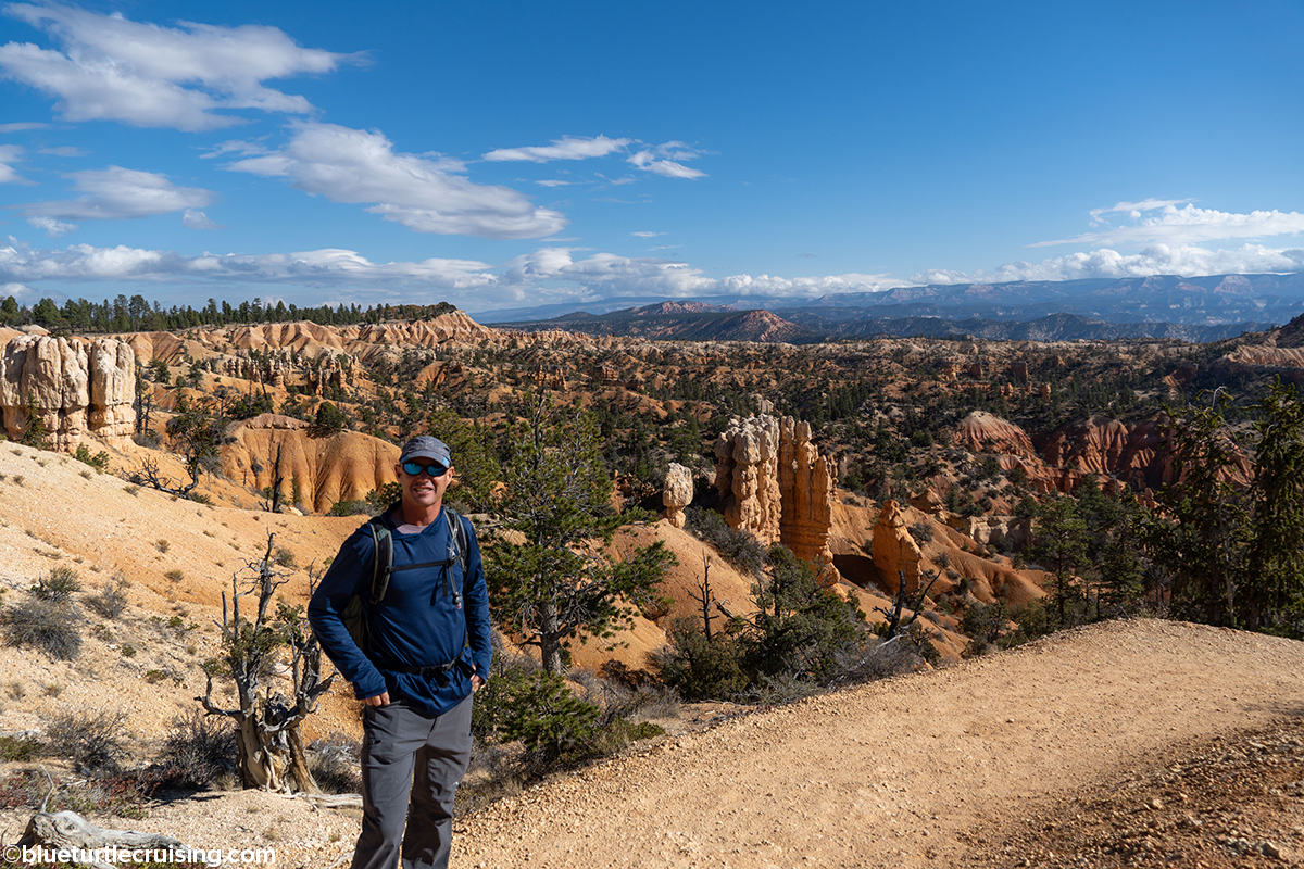
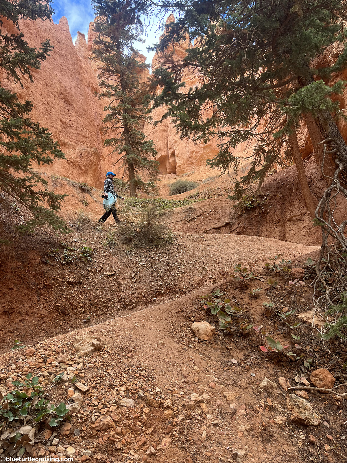
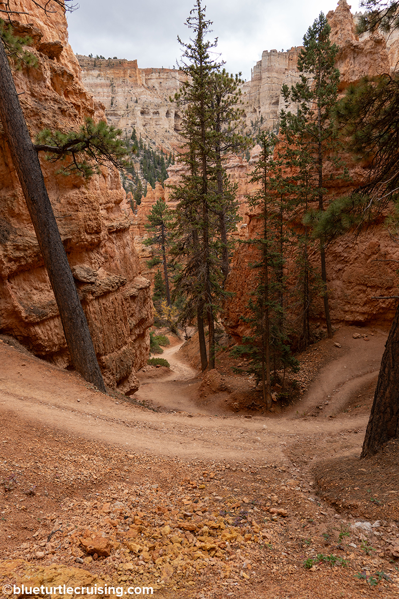
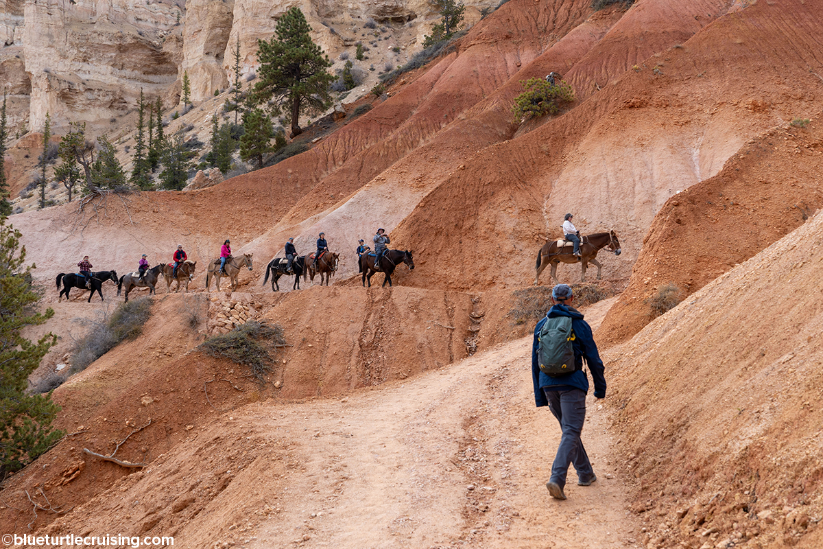
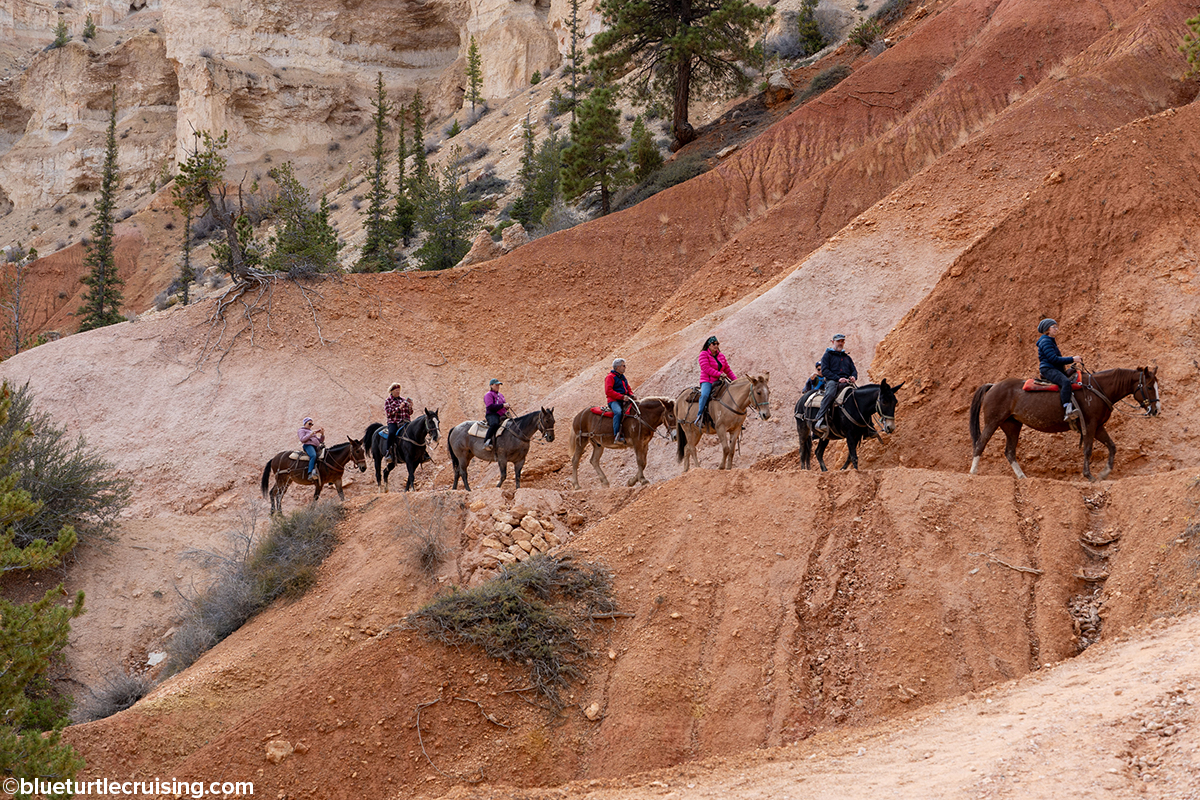
We estimated that we managed to hike roughly 40 miles in the few days we were there. Since we didn’t have the greatest weather, we were glad to have the extra days and we were able to hike some trails more than once. One thing to know about hiking Bryce Canyon is that if you plan to hike into the canyon, be prepared for some serious incline on the return trip. Also of note is the altitude which is 7,000 to 9,000 feet. While Zion National Park is only 80 miles away the temperature difference can be 10-20°. In early October, we were starting our hikes at 9am in 35-40° temps that thankfully warmed up to the 50’s. While the park does offer a shuttle, we were able to find parking at the various trailheads since it was late in the season. I imagine, the shuttle is essential when visiting in the summer months as parking is limited.
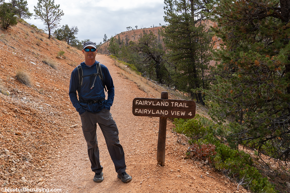
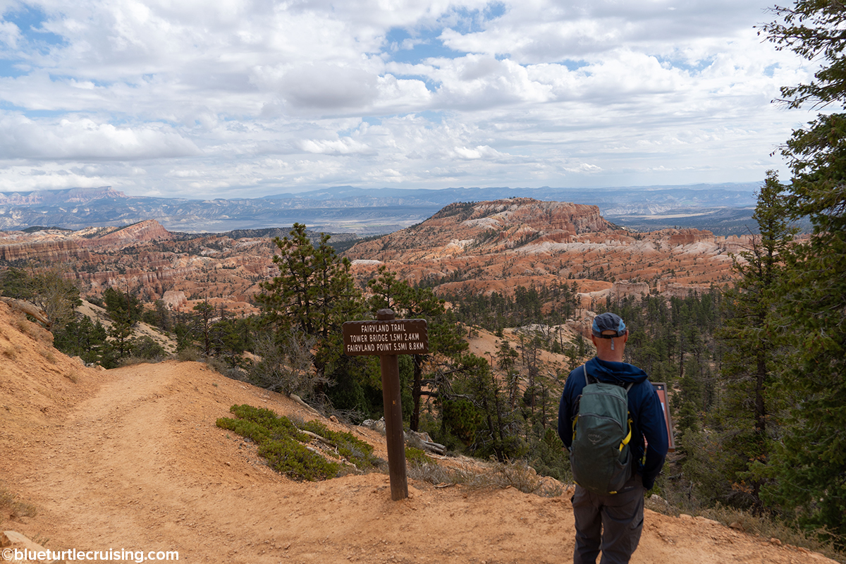
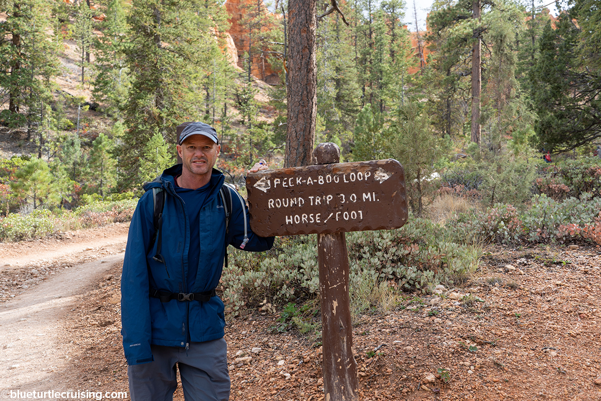
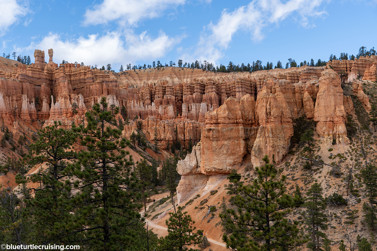
Fairyland Loop Trail
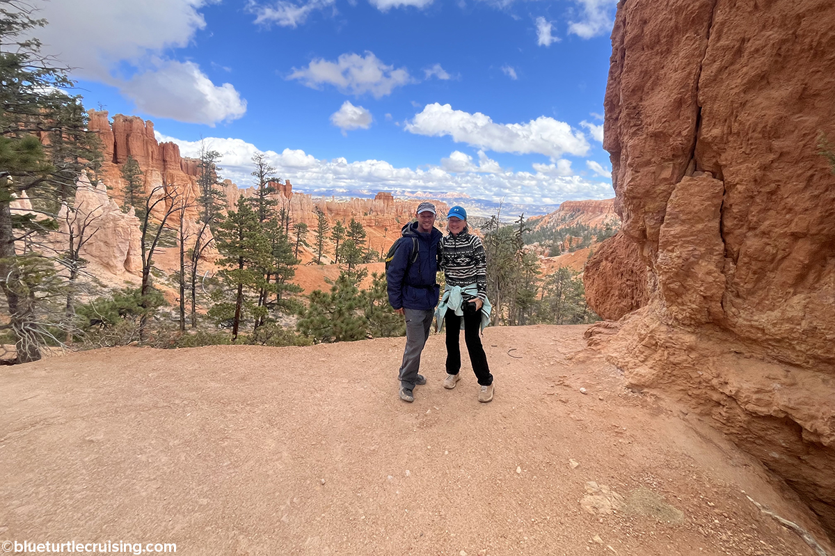
The Fairyland Loop is an 8 mile hike that combines hiking along the Rim Trail that descends into the canyon with long views of the Bryce Amphitheater surrounded by unique hoodoos. Because of the length of this trail, we found it to be less traveled. We enjoyed the trail so much we hiked it twice during our stay.
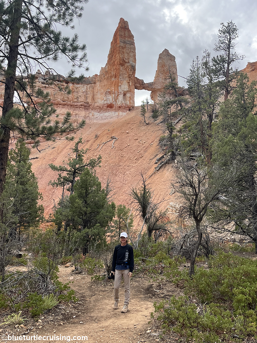
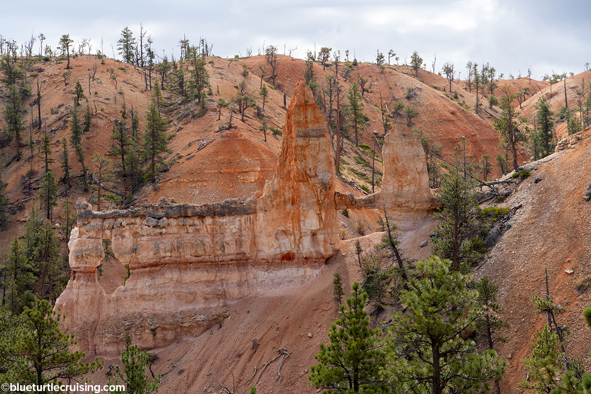
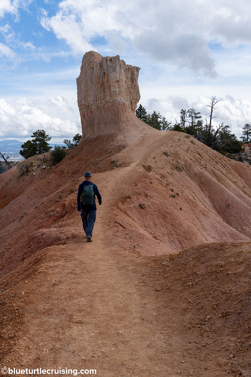
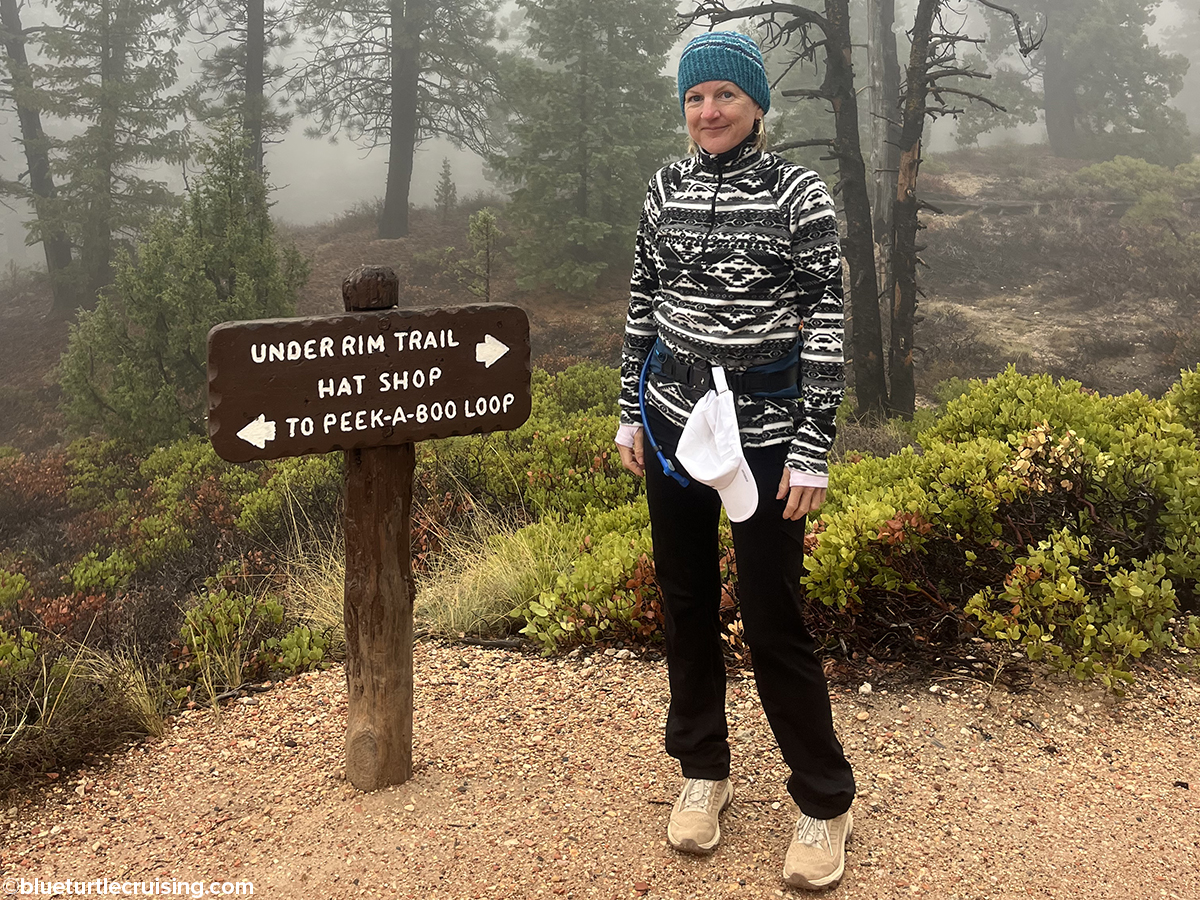
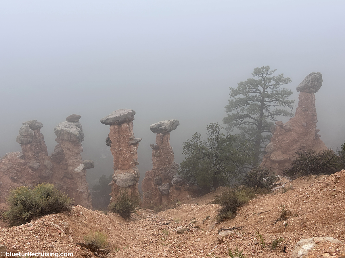
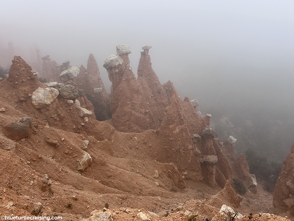
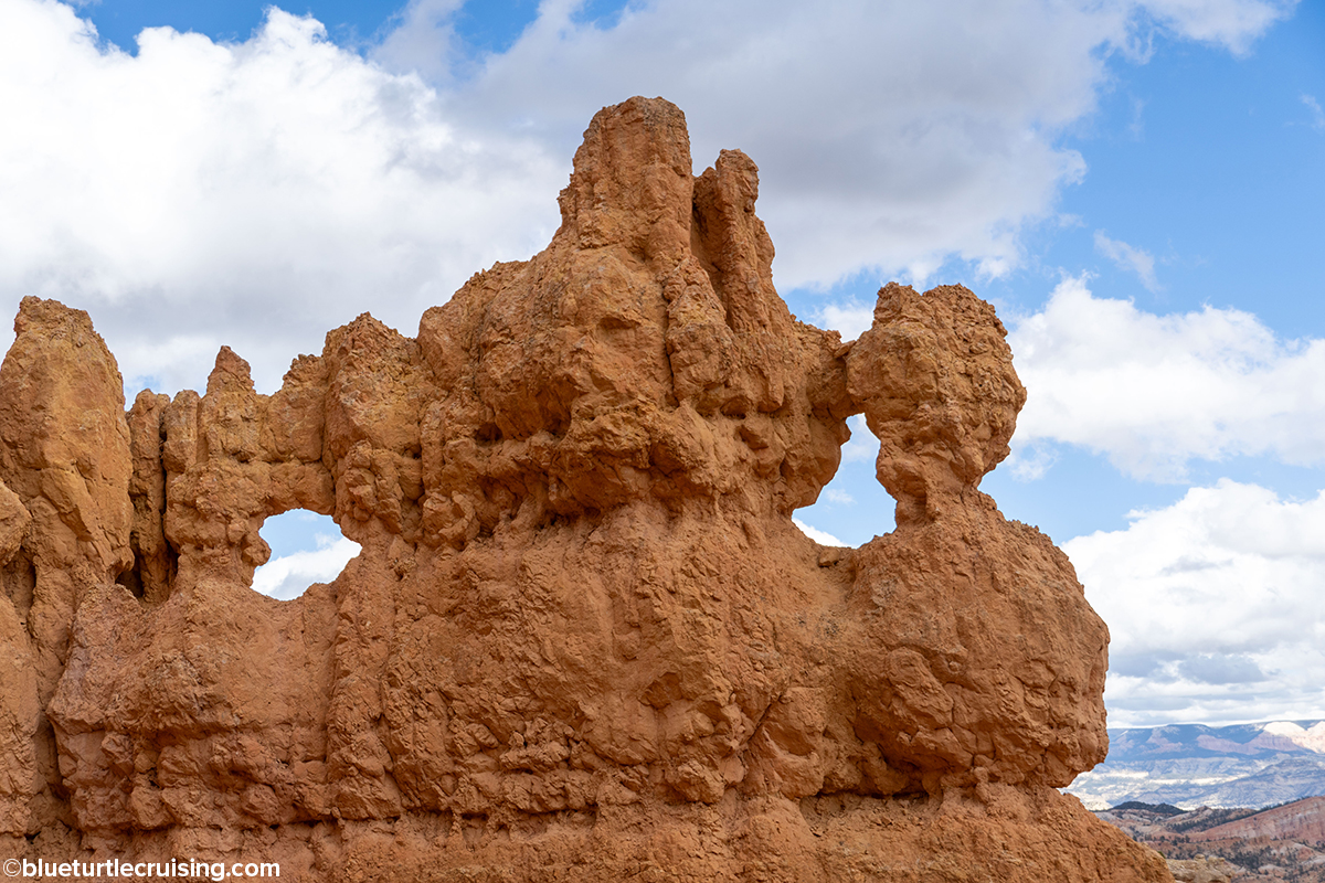
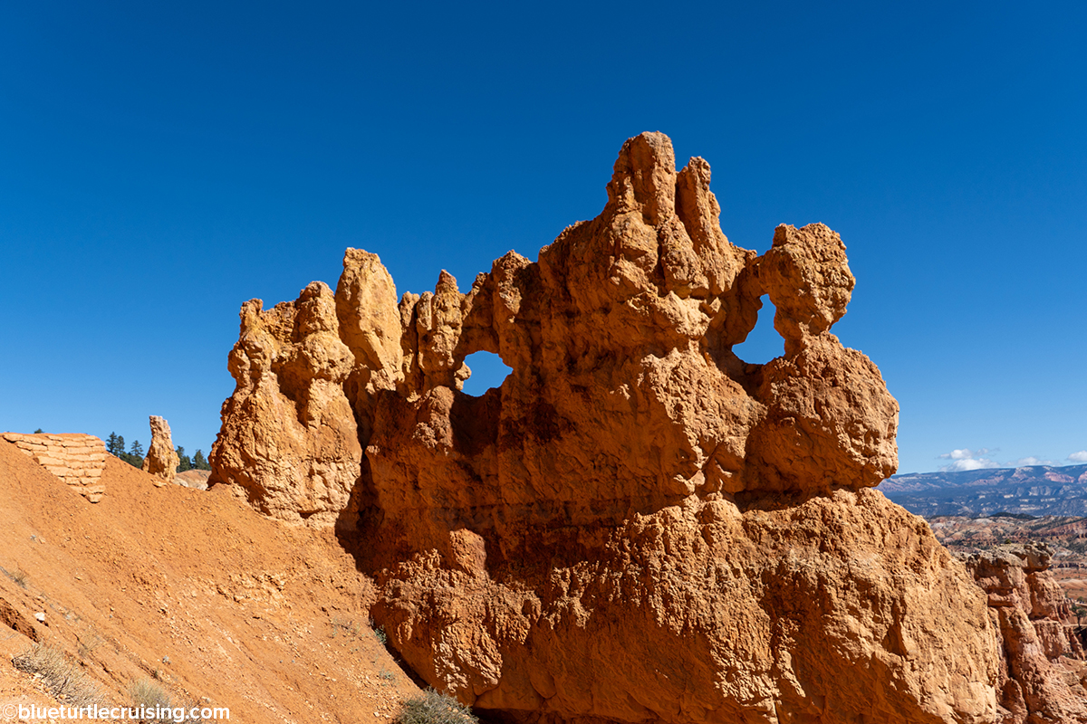
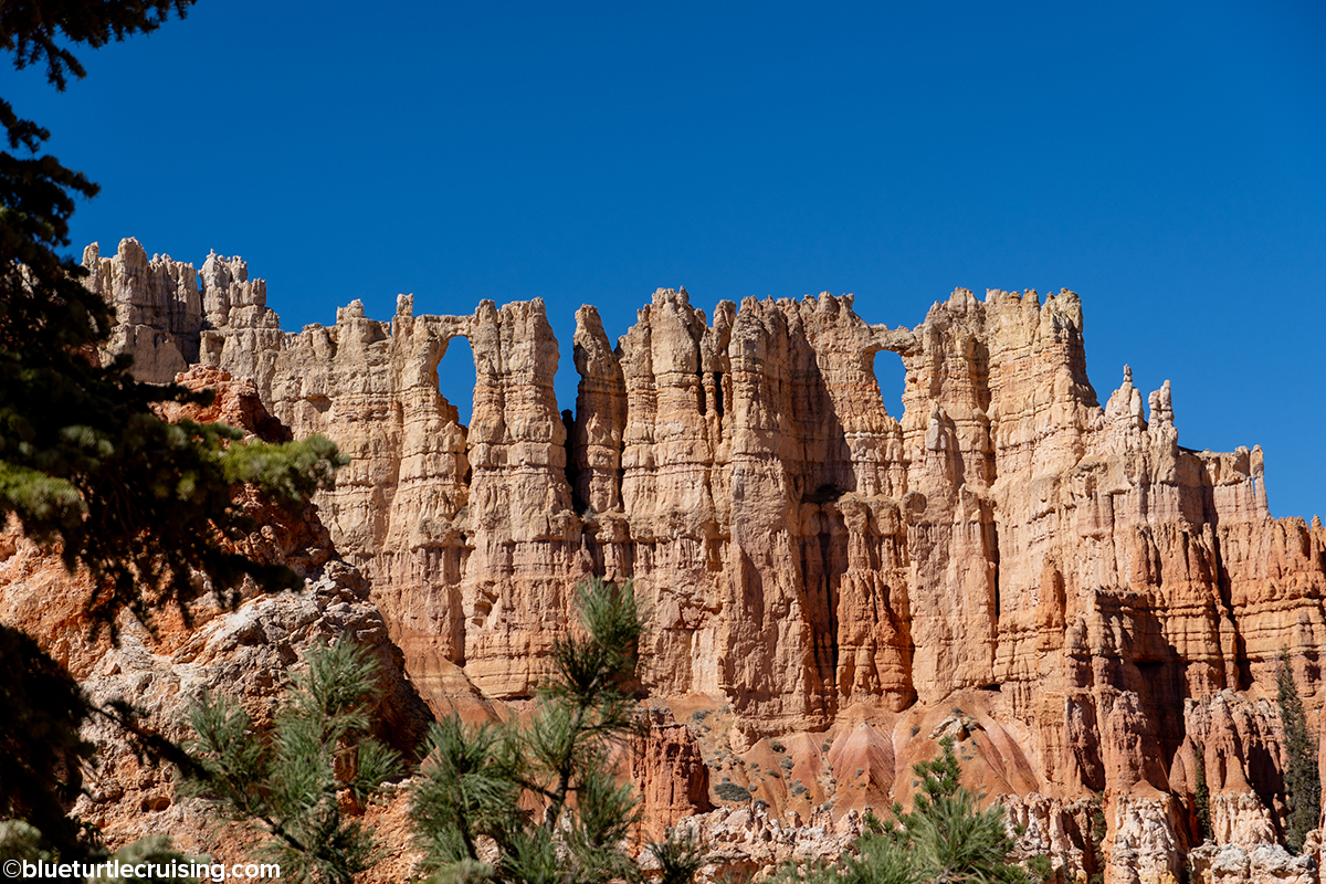
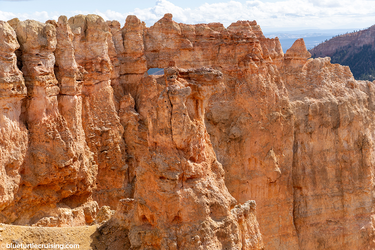
Hat Shop
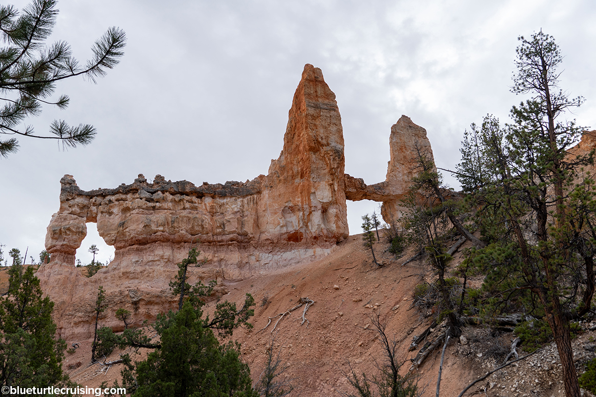
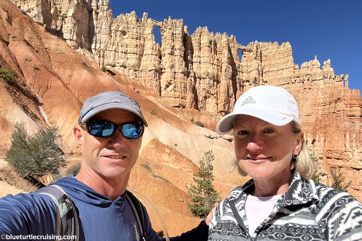
Hat Shop is a 4 mile out and back hike, however, it is considered strenuous because it descends 1,380 feet over 2 miles (which you then have to climb back up). It takes you to a cluster of balanced-rock hoodoos of narrow orange pinnacles with large gray boulders balancing on them that appear to look like hats. The day we went, the weather was miserable, foggy and damp but after spending a long rainy day on the RV previously we wanted to get out. We knew the fog would be so bad we wouldn’t be able to see into the canyon so thought maybe we could get close enough to the hat shop formations. It was still a great hike and really good exercise, however, we had to navigate some crazy mud in some areas.
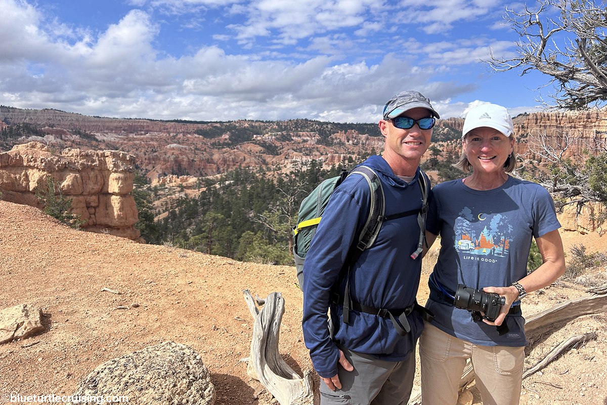
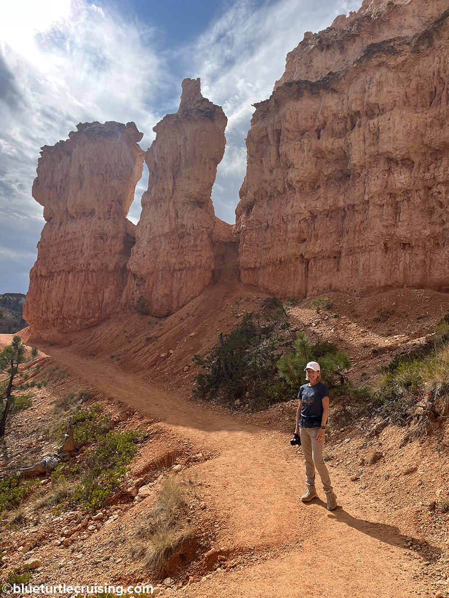
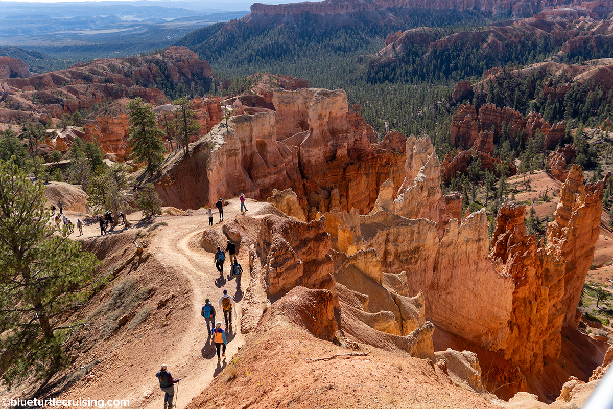
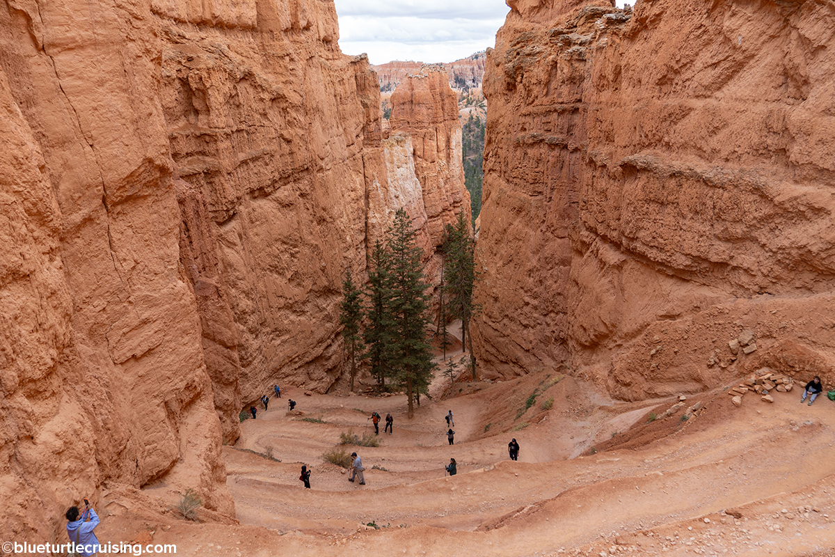
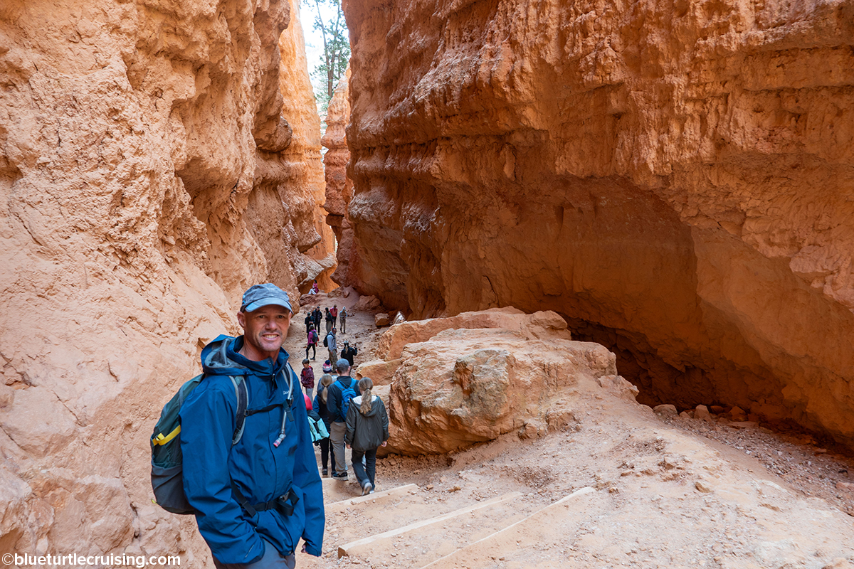
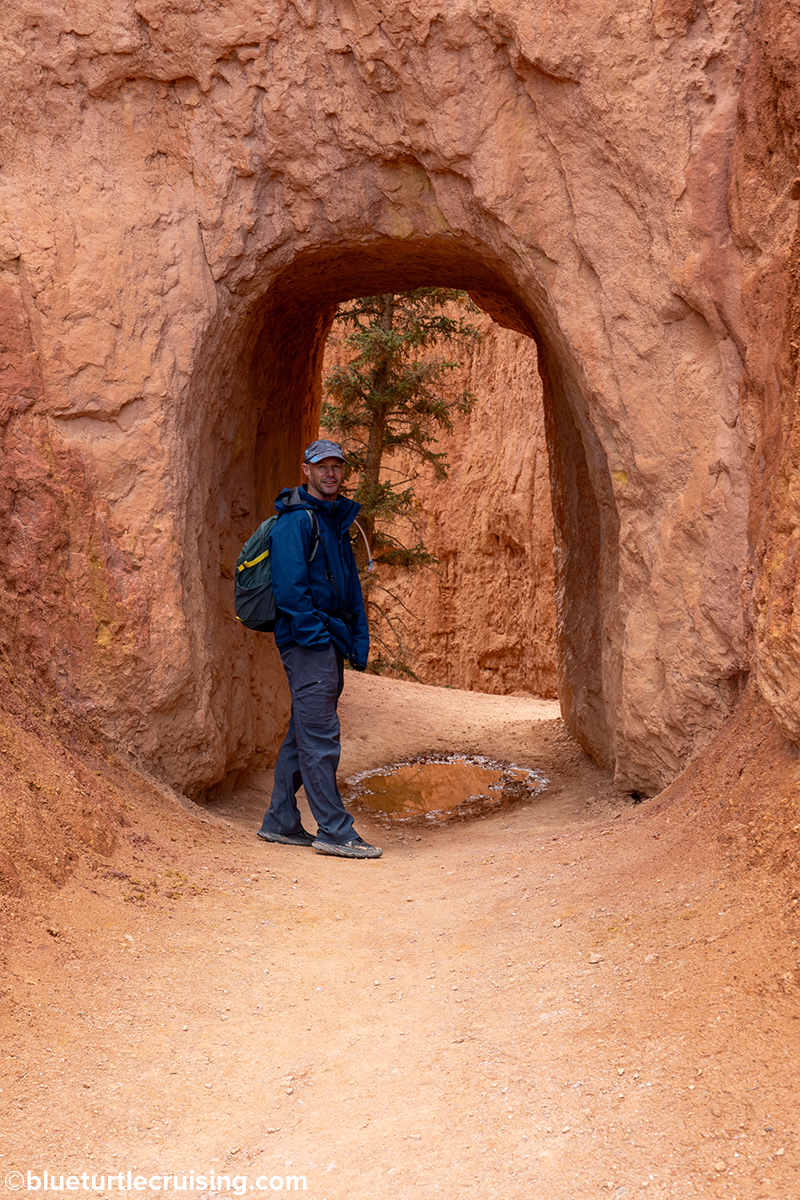
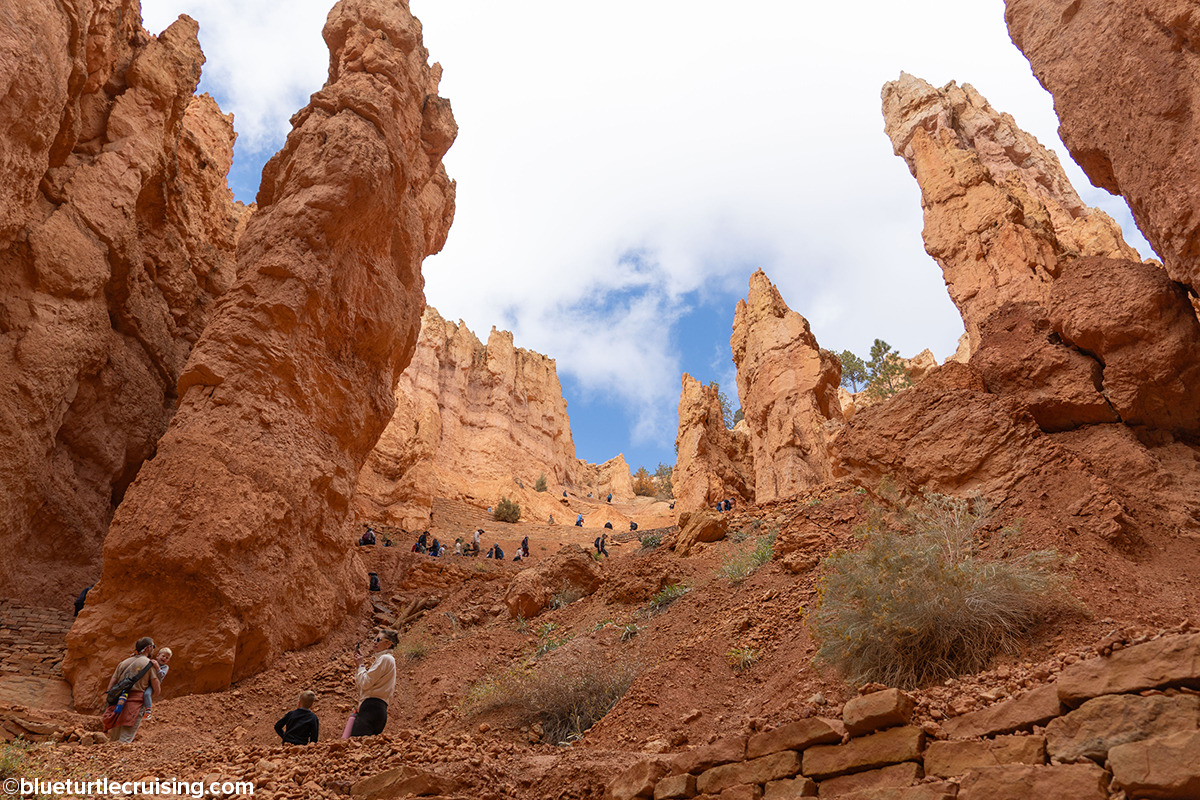
Queen’s Garden Trail, Navajo Loop, and the Peekaboo Loop
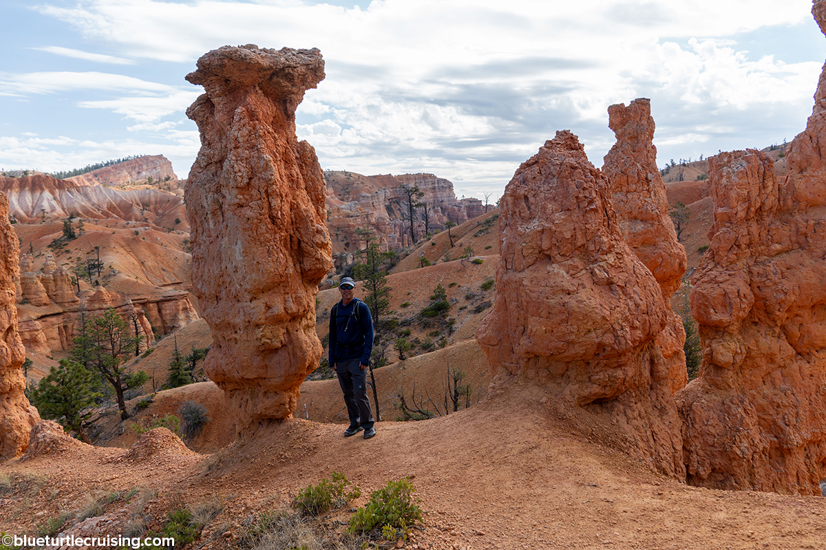
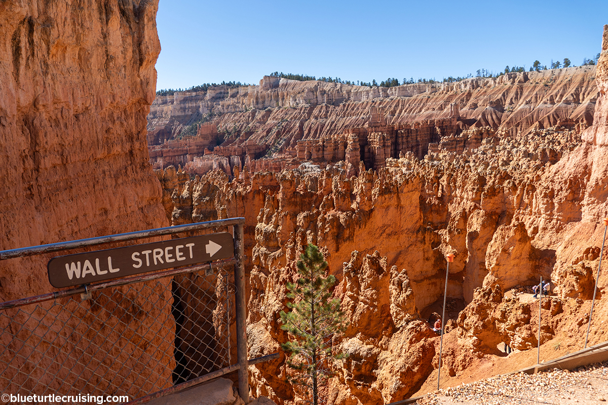
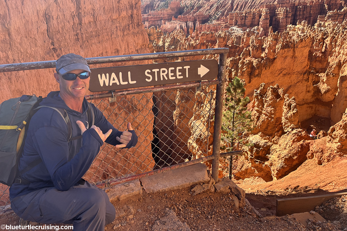
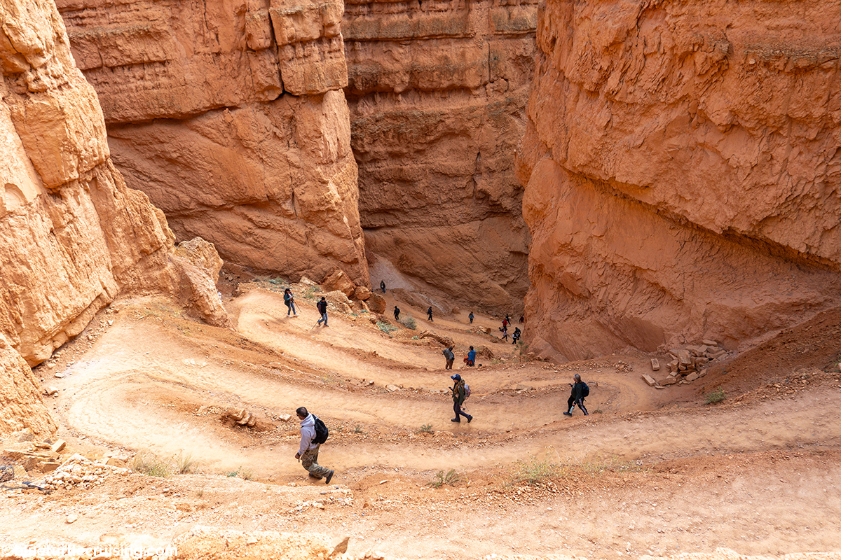
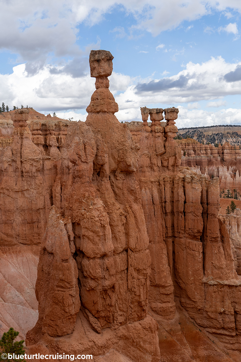
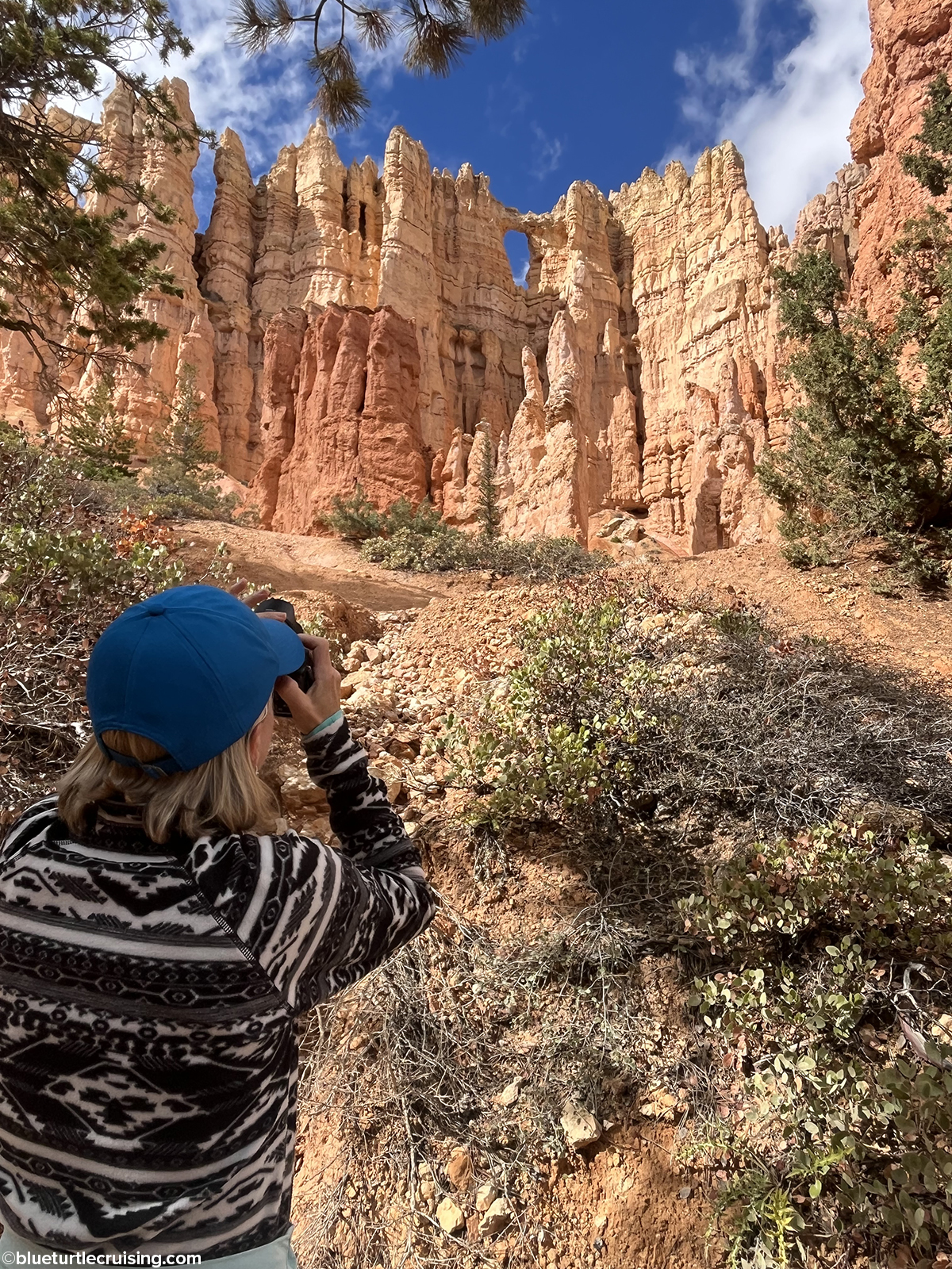
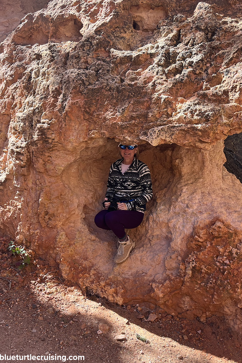
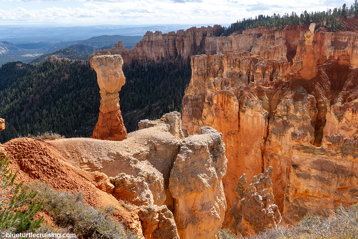
We spent 2-3 days hiking various combinations of the Bryce Amphitheater trails Queen’s Garden, Navajo Loop and Peekaboo Loop trails. Navaho Loop, probably the most popular trail in the park, has 2 sides: Two Bridges and Wall Street. It is under 2 miles but has some serious decline and incline over switchbacks. Views include Two Bridges and famous hoodoo Thor’s Hammer. Queens Garden is the least difficult of the trails descending from the rim into the amphitheater and is commonly used to connect with the Navajo Loop. We found both Navajo and Queens Garden extremely crowded and found another trail, Peekaboo Loop, that connected off Navajo was a little less traveled, probably because it added an additional 3 miles before having to climb back up Navajo. While Navaho Loop was very congested, it was absolutely stunning to see the switchbacks and narrow walls of colorful limestone. Once we got past the crowd and onto Peekaboo Loop we were able to relax more and enjoy the gorgeous views. The Bryce Amphitheater trails were probably the most stunning and scenic.
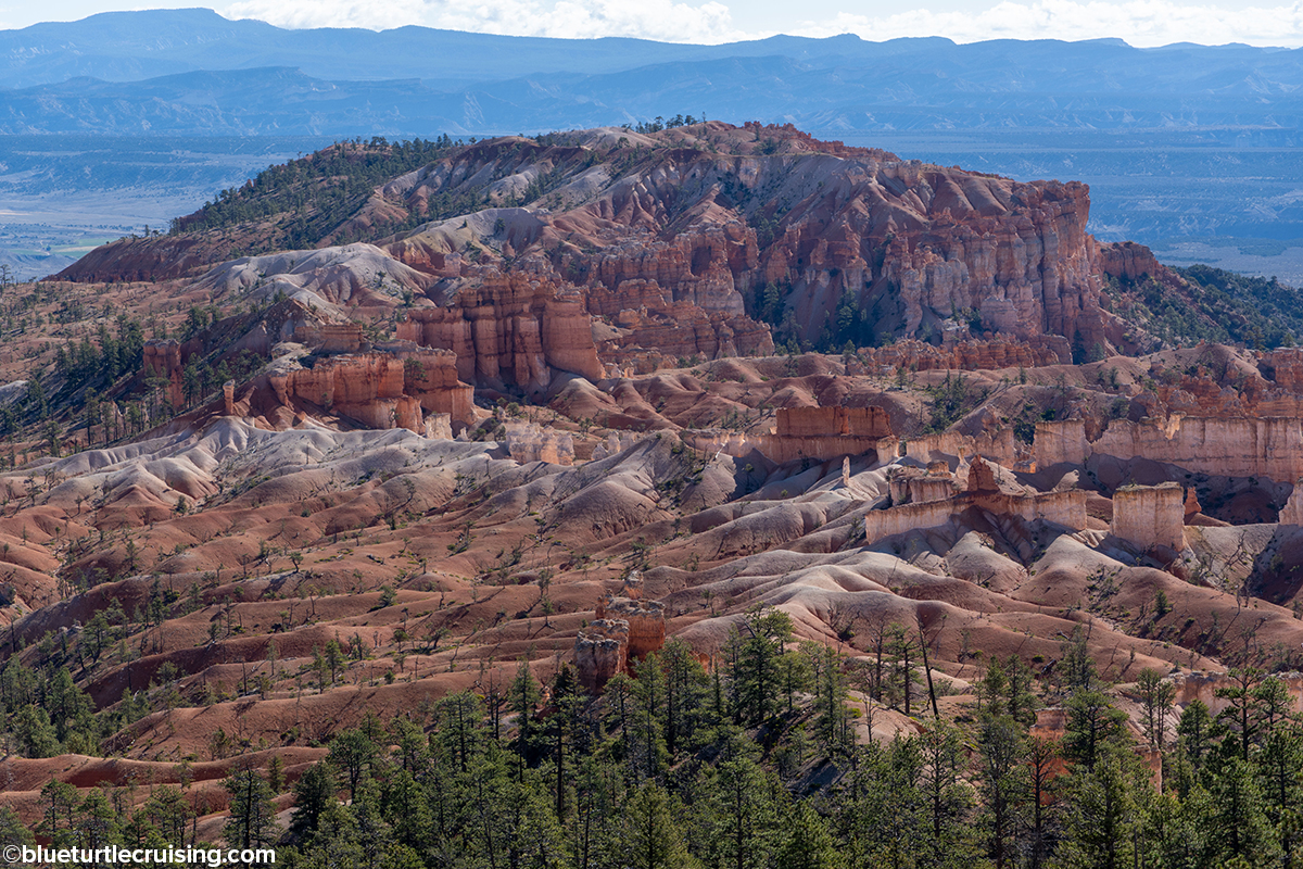
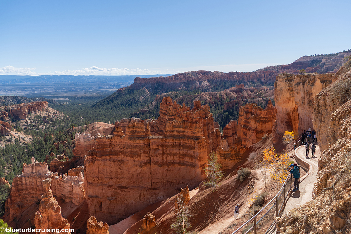
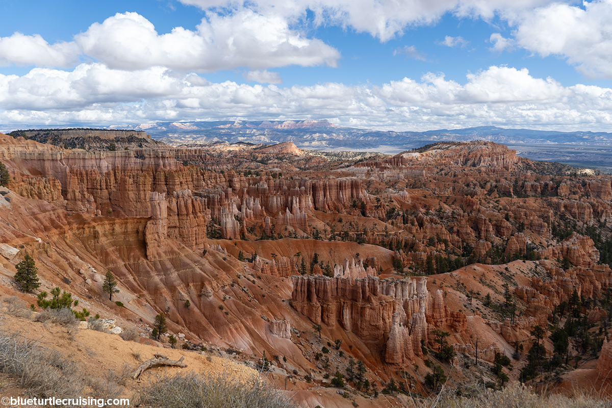
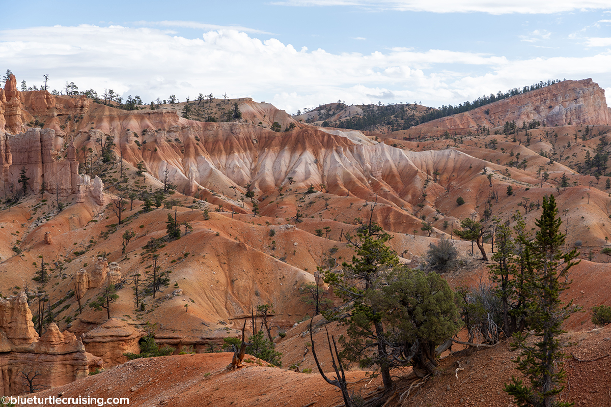
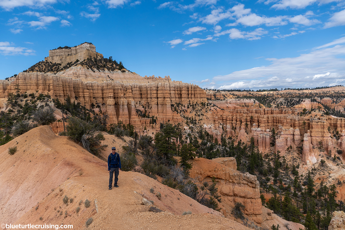
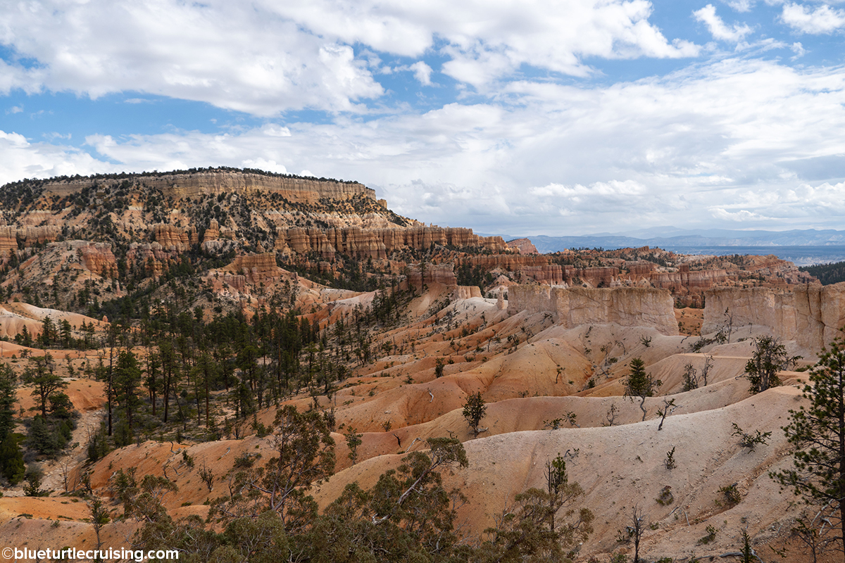
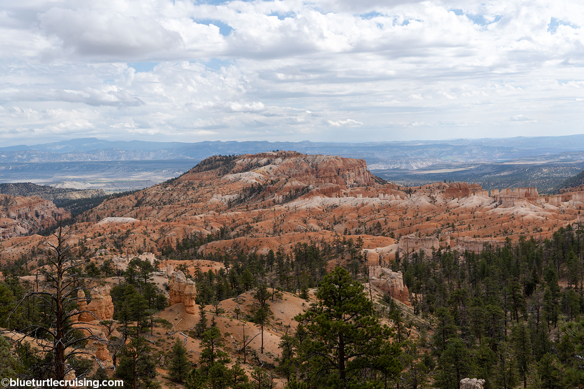
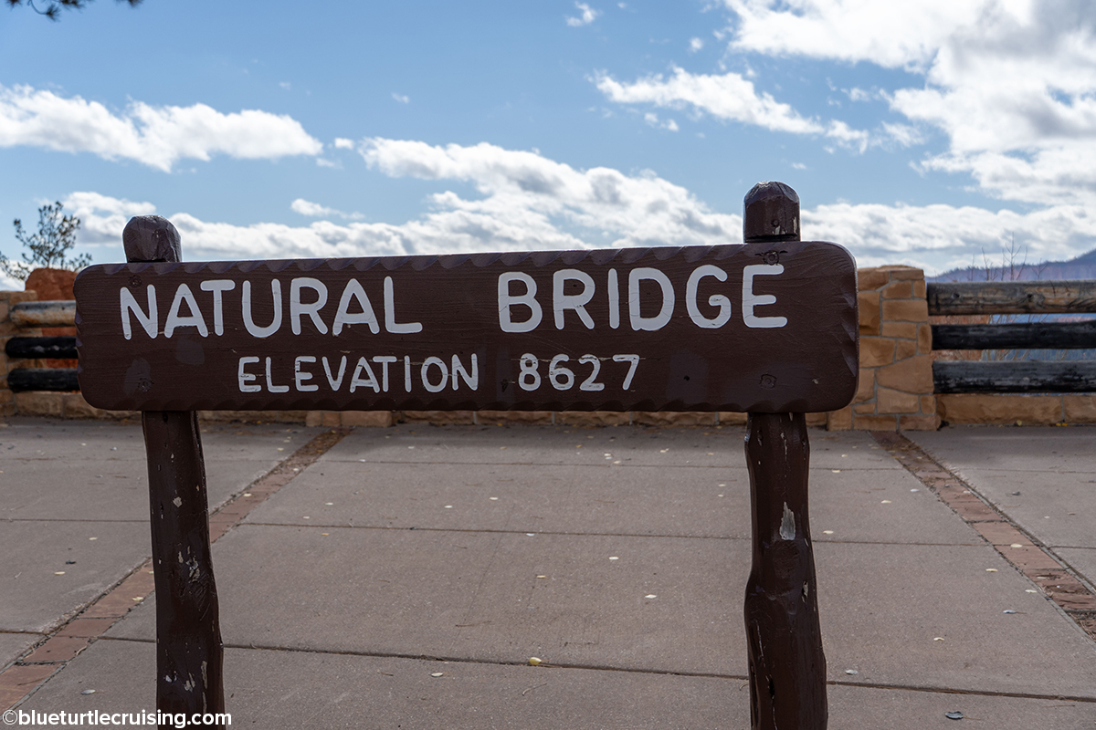
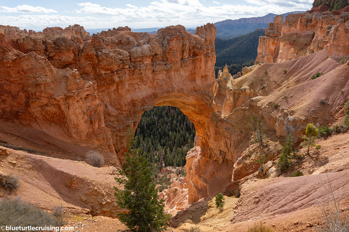
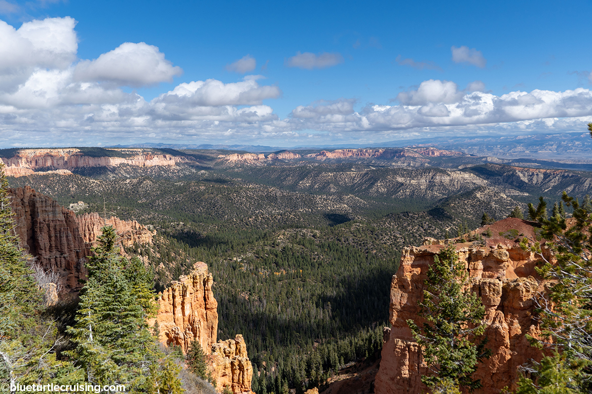
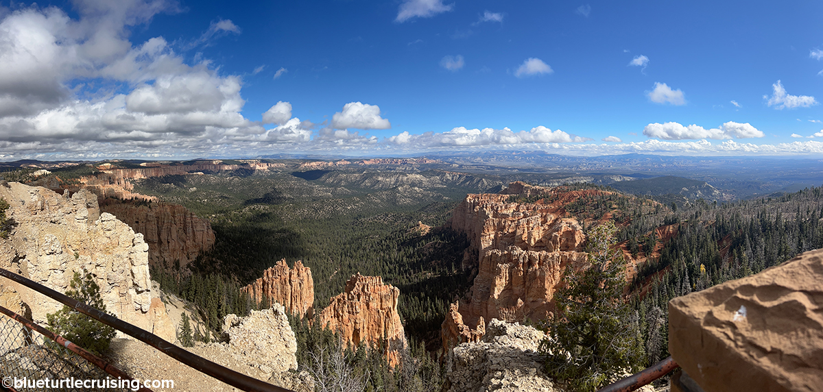
Natural Bridge and Rainbow Point – Southern Scenic Drive
While the Bryce Amphitheater area and trails are found along the first 3 miles of the park, the next 15 miles to the road’s end are known as the Southern Scenic Drive. This drive has 9 scenic overlooks including the rock formation known as Natural Bridge. As you drive south the elevation changes from 7,800 feet to 9,000 feet at the road’s end at Rainbow at Yovimpa Points. From here, you have the highest viewpoint overlooking the park.


Awesome way to end your trip before returning to Florida! Beautiful!!!!! Well done. I wish I could have joined you at some point but too much for me this year. Aloha