
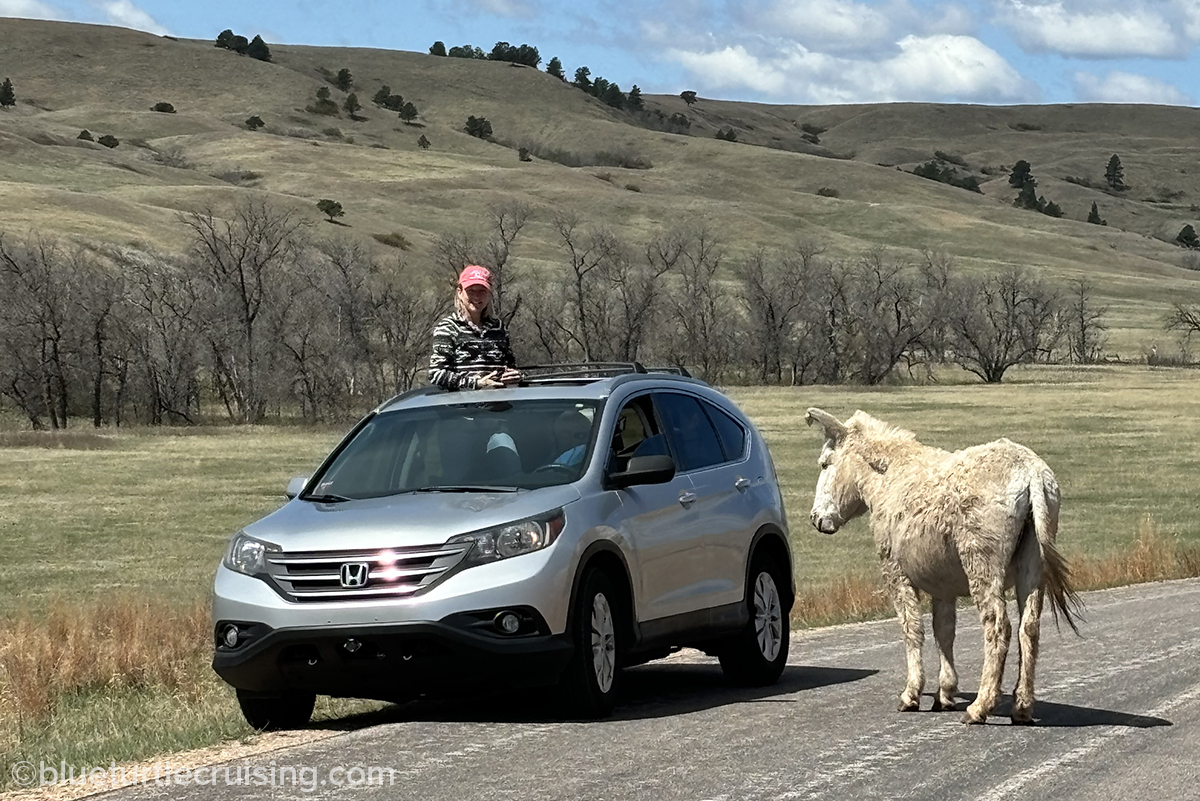
Custer State Park, located in the Black Hills in South Dakota encompasses 71,000 acres and is South Dakota’s first and largest state park. With granite peaks, rolling prairie fields and clear lake waters it’s not hard to imagine why so many flock here in the summer. There’s something for every outdoor enthusiast from swimming, fishing and kayaking to hiking, biking and rock climbing. It’s also an amazing place to view wildlife like bison, pronghorns (antelope), burros, prairie dogs and more.
Randy and I bought a season pass upon our first visit since we knew we’d be back again multiple times over the summer for the hiking and wildlife viewing. After driving through the scenic loops of the park, I couldn’t believe this wasn’t a national park. It’s such a gem of a place. With a diverse landscape going from granite spires to the rolling plains of the Wildlife Loop and the amount of wildlife you could see, it was one of the most amazing parks I’ve seen.
Scenic Drives
The park has 3 scenic roads you can drive that take you through Custer State Park: Needles Highway, Wildlife Loop and Iron Mountain Road. We pretty much drove all of them several times during our summer. To do them all takes a few hours but there are plenty of stops and pull offs along the way.
Needles Highway is a 14-mile road that gets it’s name from the the needle-like granite formations you see as you drive. You can connect with the Peter Norbeck Scenic Byway from it to get to the Wildlife Loop.


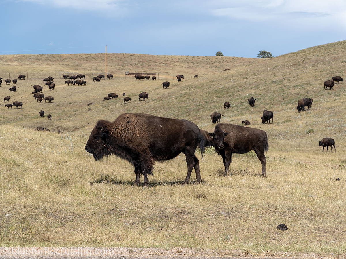
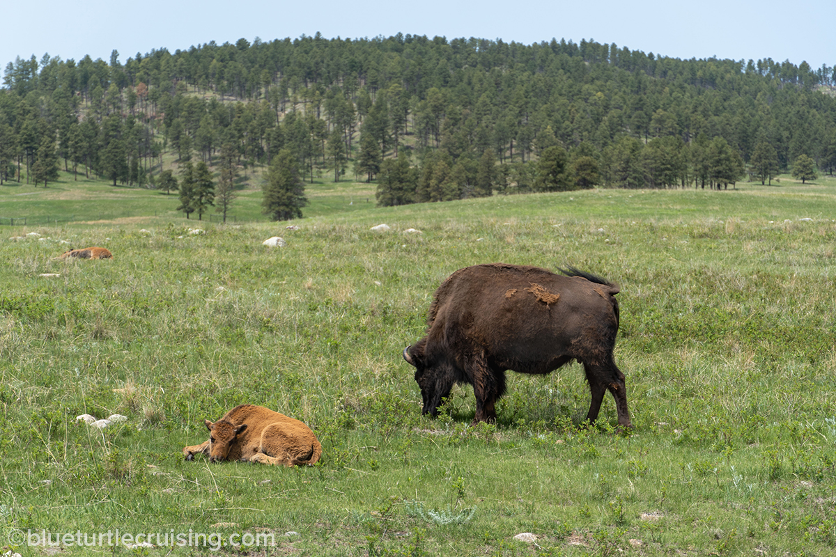
Wildlife Loop Road is 18 miles long and takes you through open prairie fields where you can spot bison, elk, bighorn sheep, pronghorns, prairie dogs and more. It was our favorite drive as we love spotting wildlife.


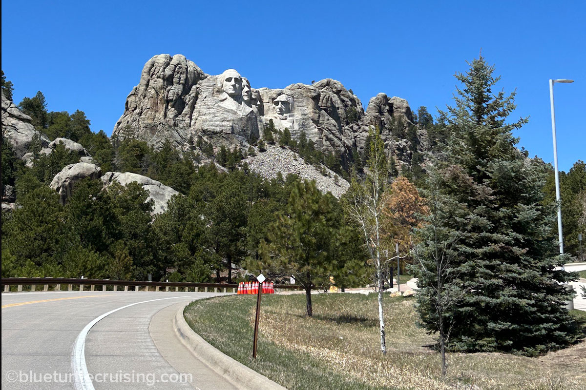
From the Wildlife road we would take the Norbeck Scenic Byway and connect to Iron Mountain Road. This winding road takes you through magnificent Black Hills scenery and tunnels that frame Mount Rushmore. We’d take this road to connect to the Norbeck Scenic Byway that would take us by Mount Rushmore to Keystone where we’d loop around to Black Elk Resort where we were staying.

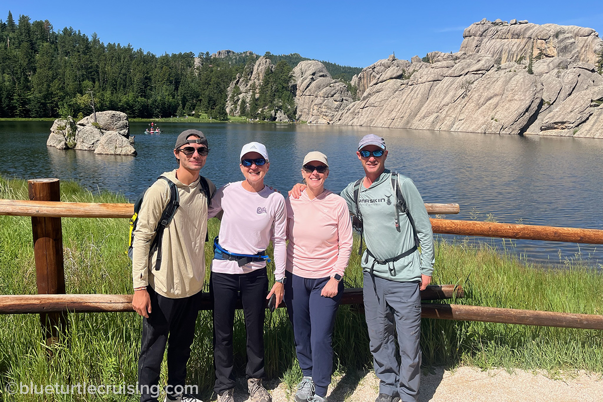
Sylvan Lake
While there are 5 lakes in Custer State Park, Sylvan Lake was the one we most frequented. This was mostly because it’s where the hiking trailheads of #4 and #9 were located as well as the Sunday Gulch trailhead. The lake itself is very picturesque with rock formations around it and protruding from the lake. There’s a 1 mile walking trail around the perimeter of the lake (Sylvan Lake Shore Trail) and a lodge nearby for food, drinks and souvenirs. Most folks visit for the hiking trailheads or to fish and paddle board the lake. Sylvan Lake was also featured in the 2007 film National Treasure: Book of Secrets, starring Nicholas Cage.


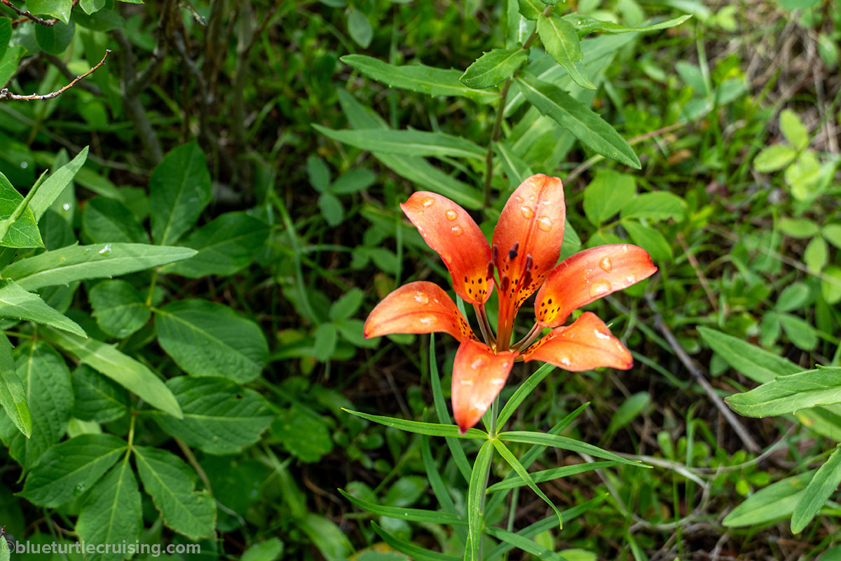
Wildlife and Wildflowers
Wildlife was abundant in the park and wildflowers were in full bloom during June and July. As mentioned above, you could spot bison, elk, bighorn sheep, pronghorns and prairie dogs on the Wildlife road. Other wildlife we spotted throughout the park were white-tailed deer, chipmunks, groundhogs, Canadian geese and a plethora of birds. Summer months brought wildflowers on the trails that reached the hips. It was stunning!


Hiking
Hiking in the Black Hills is world-class and Custer State Park offers some of the best trails to get outdoors. We didn’t do all of the hiking trails in the park because we tend to go for the longer (6+ miles) and more strenuous hikes. Below are our favorite hikes in the park and many of them we did multiple times over the summer.
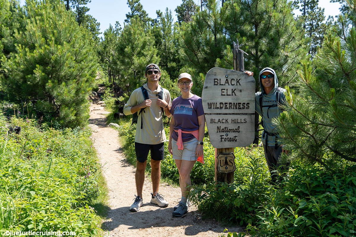
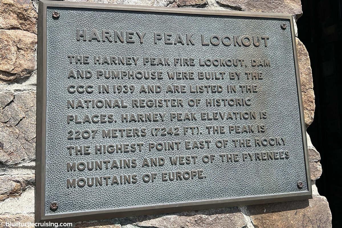
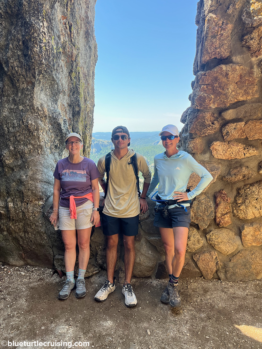
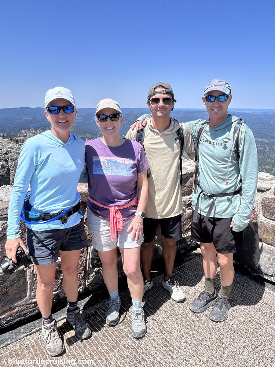
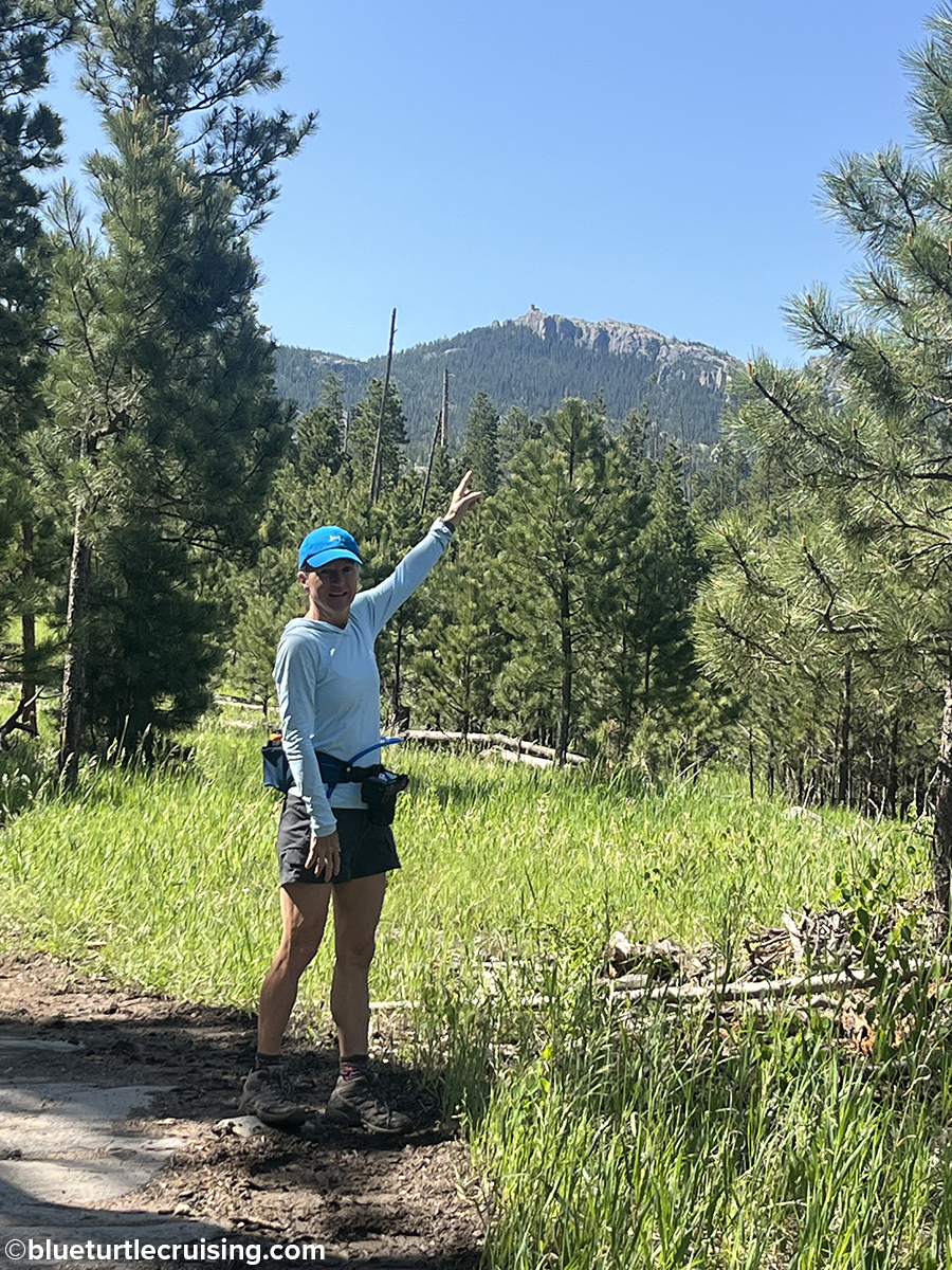
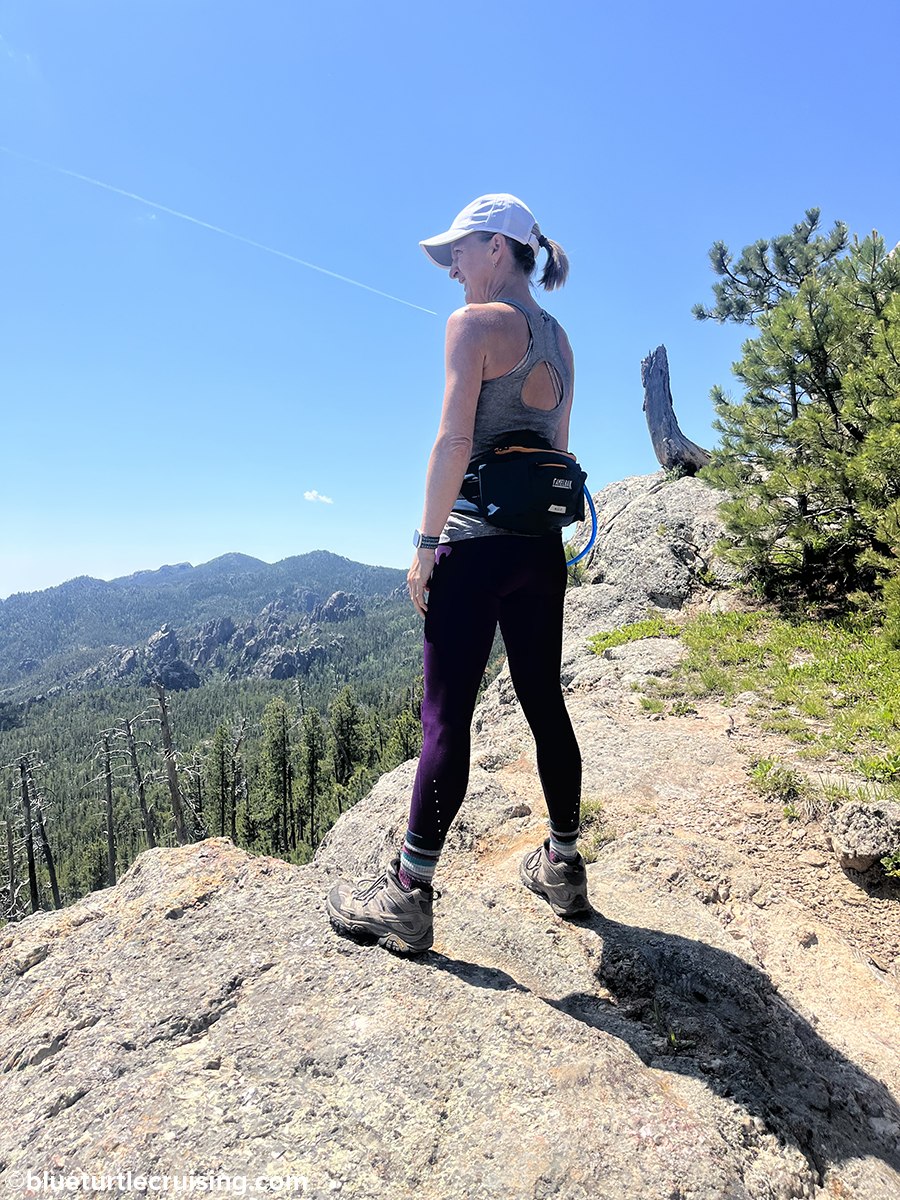
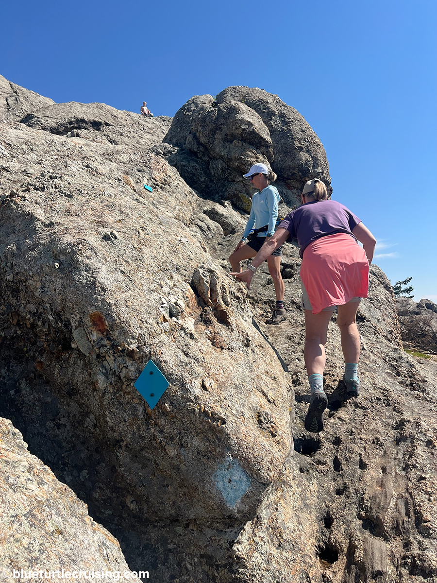
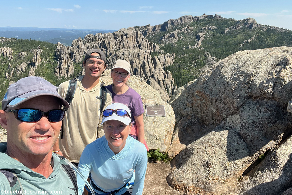
Black Elk Peak
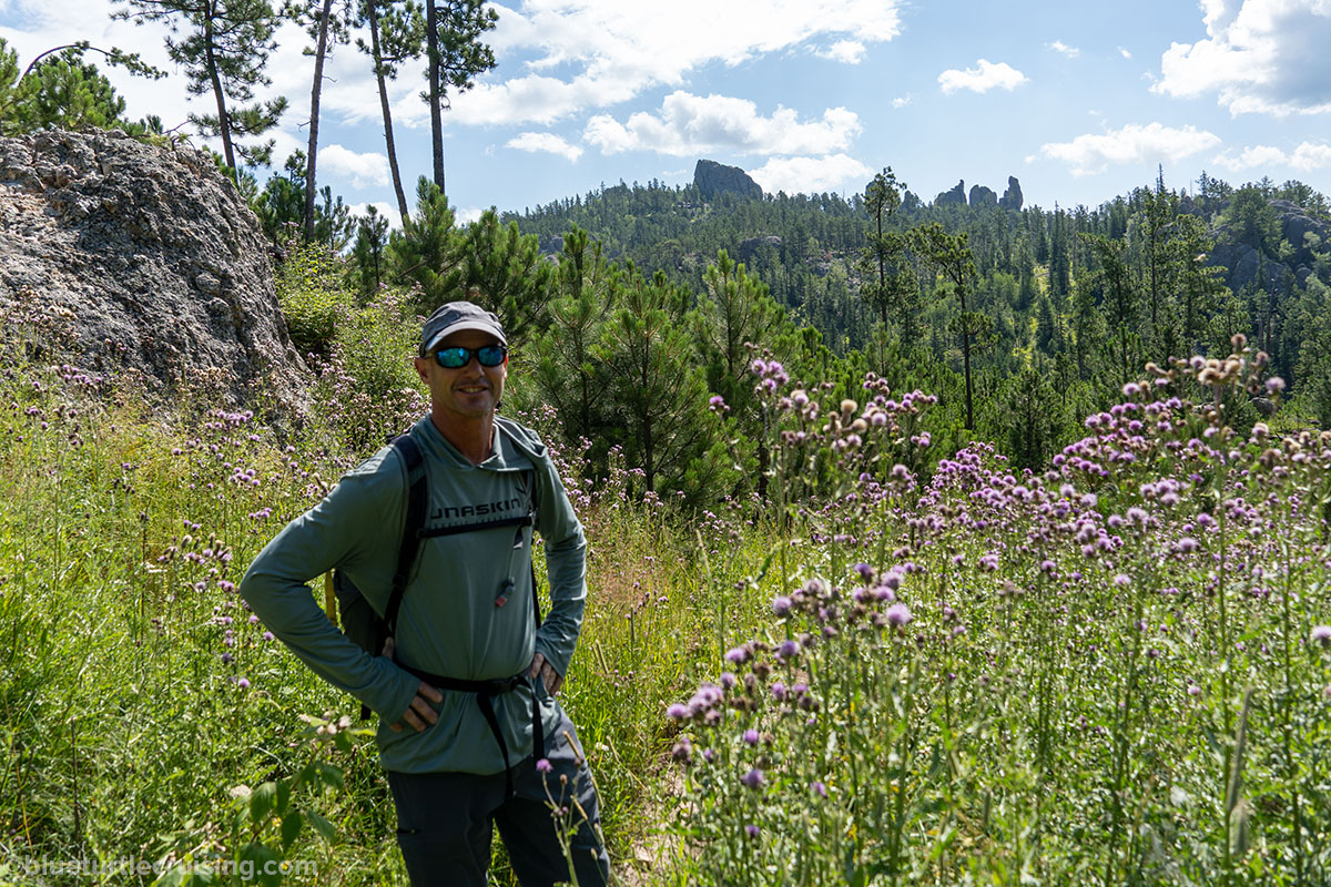
One of the most popular hikes in Custer State Park (and our favorite) is Black Elk Peak. At 7,242 feet elevation, Black Elk Peak (formerly Harney Peak) is the highest point in South Dakota and east of the Rocky mountains. It’s also one of the longer and more strenuous hikes but the pay off at the end is incredible views from the top. There are several different ways you can get to Black Elk Peak. The #9 trailhead from Sylvan Lake is the most popular and congested route. It’s 3.3 miles to the top, making for a round trip of just over 6 miles. You can also take the #4 trailhead from Sylvan Lake and connect to the #9 on up to Black Elk Peak. We love going this way because it takes you past Little Devils Tower and Cathedral Spires. It makes the hike a little longer but it’s very cool to see the rocky spires along the way.


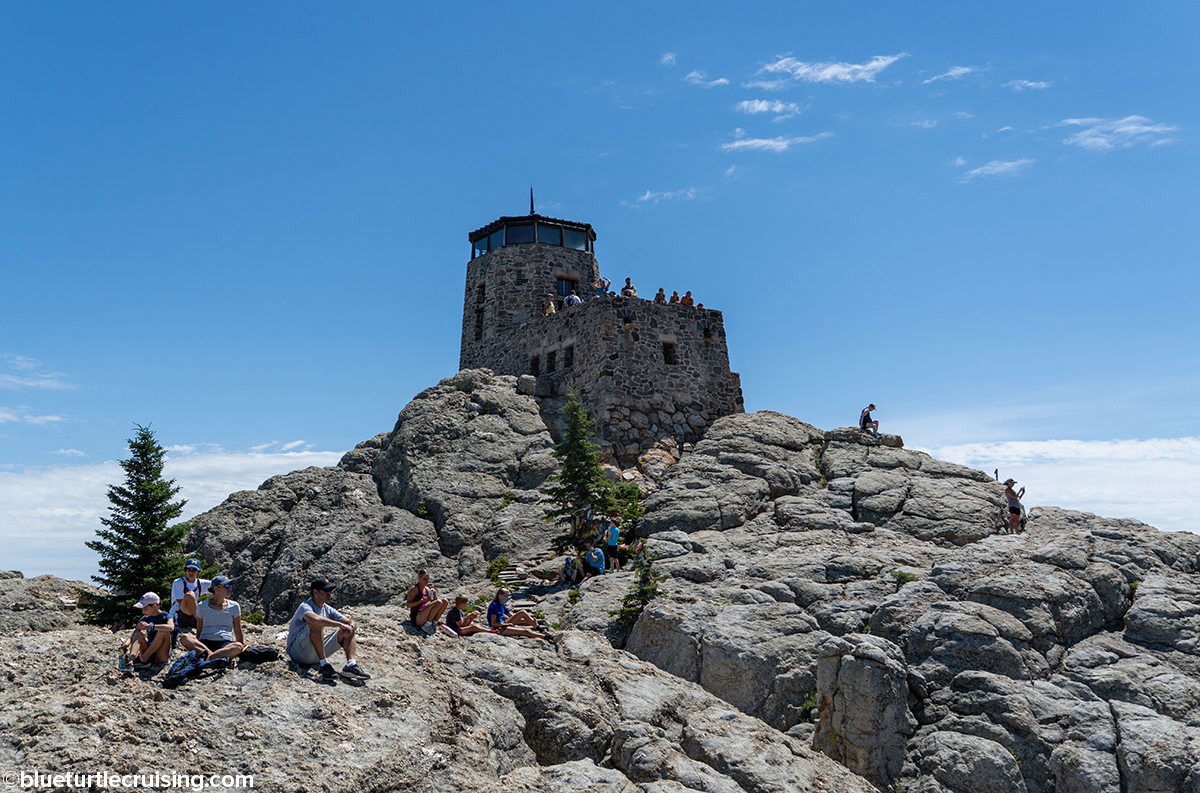
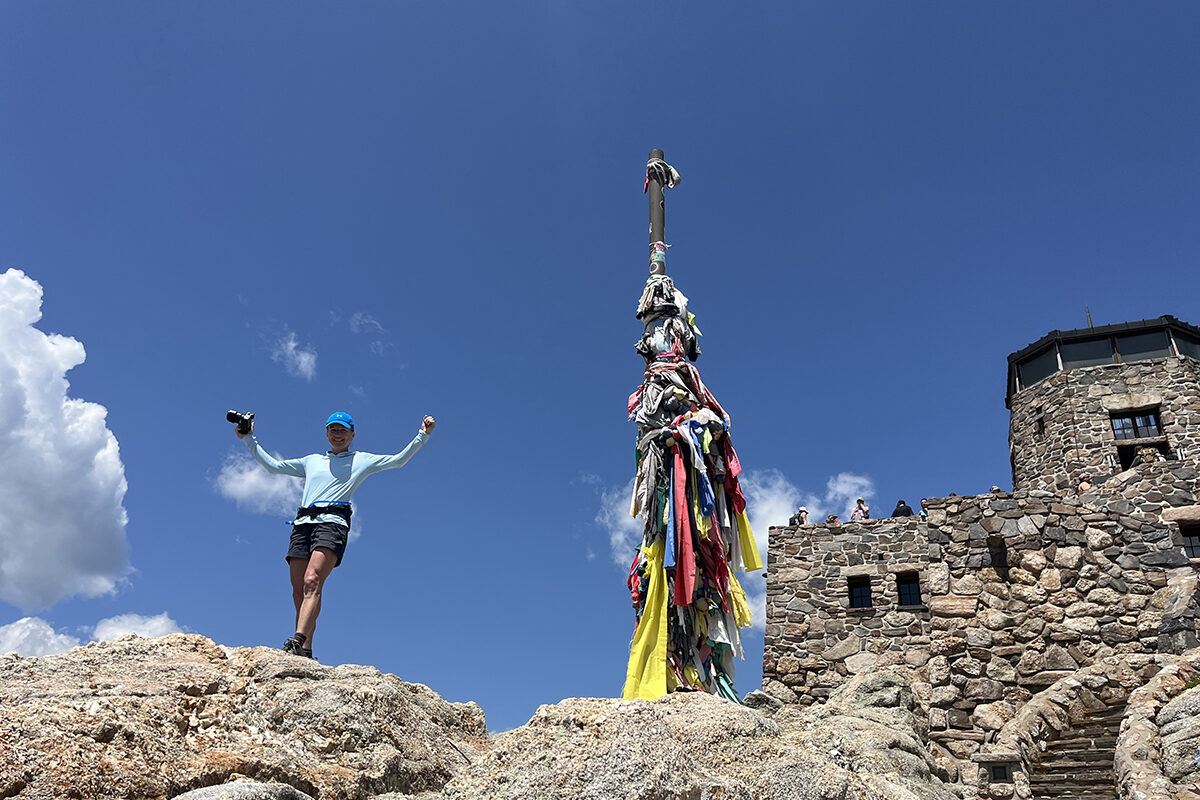

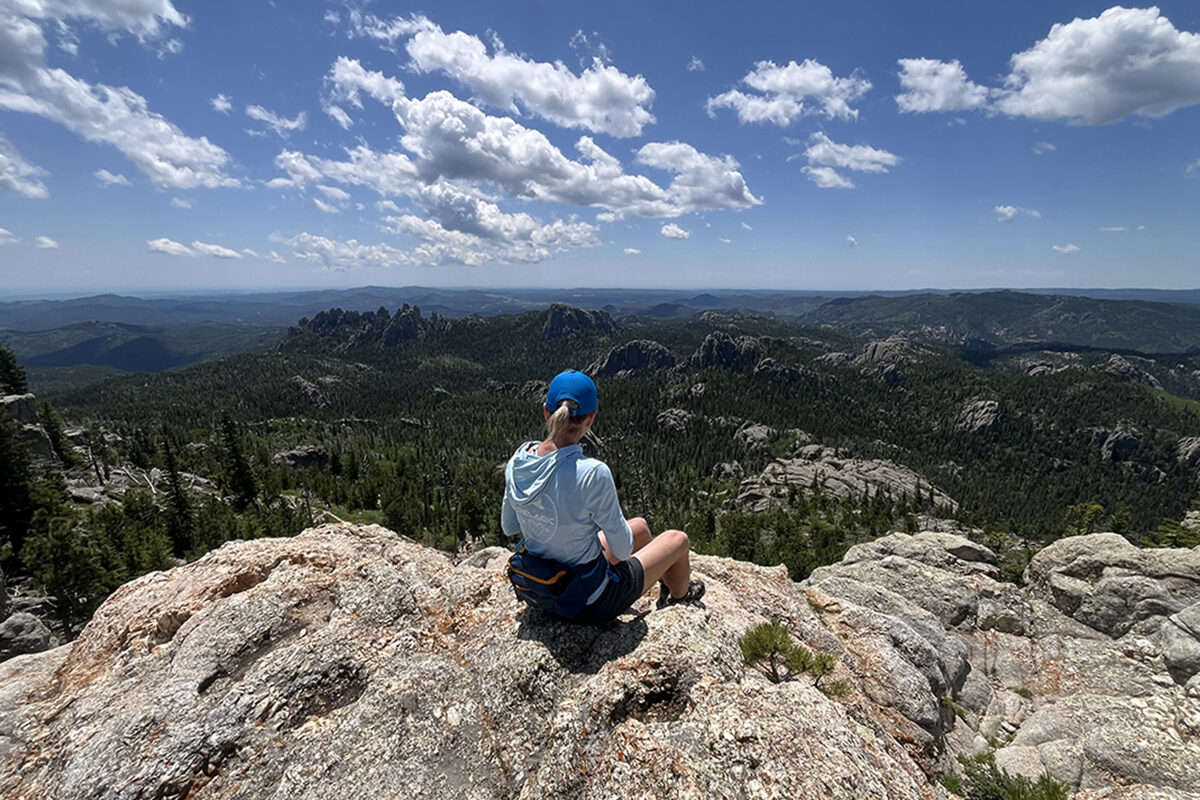

While we love the #4 trail route, it’s still not our favorite way to get to Black Elk Peak. Shortly after our first couple hikes to the summit, Randy discovered another route, referred to as the “North 9” trail. The #9 trail basically takes you from Lake Sylvan up to the summit and over it leading you down to Mount Rushmore Blvd. Basically, it’s the backside of the #9 trail. One of the reasons we love this route is because it’s less travelled, most likely because it’s a longer way to get to Black Elk Peak. The trail is 5 miles to the summit making it a 10 mile round trip with an elevation gain of 2,500 feet. Most of the hike is uphill to the summit and some areas are technical but there are AMAZING views along the way before you reach the top. We probably hiked this Black Elk Peak trail the most.


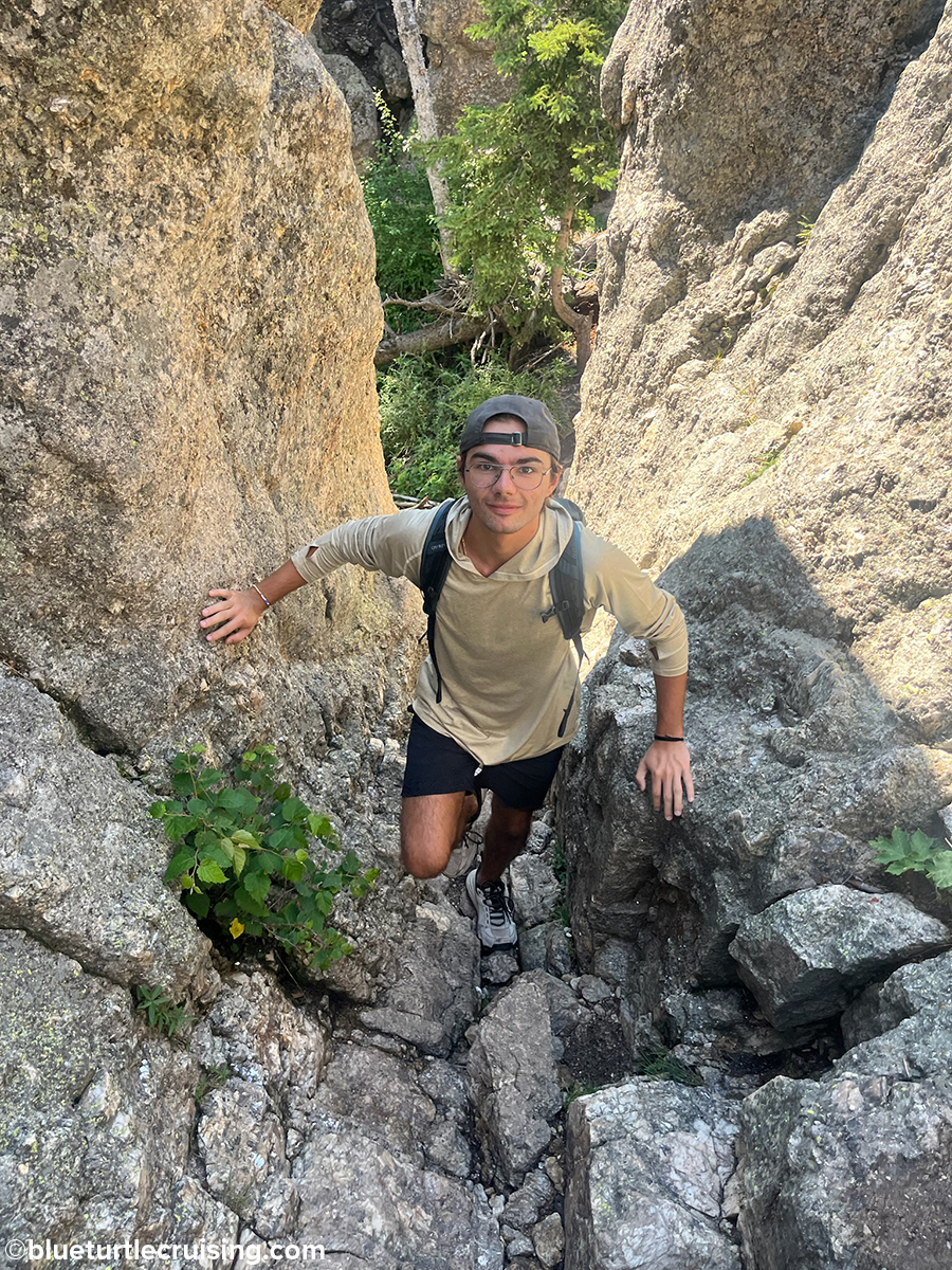
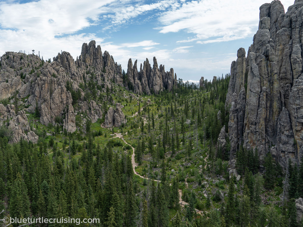
Little Devils Tower
Little Devils Tower is about .5 miles (one way) off the #4 trail and is the most thrilling trail in the park. It gets its name from the rock formations that resemble the Devils Tower Monument in Wyoming. Whenever we took the #4 to Black Elk Peak we’d do this one as well. It involves some bouldering and passing through a narrow crevice to get to the top. Definitely not a hike for an acrophobe. At the top you get a 360° view of the Black Hills and the Black Elk Peak summit and Cathedral Spires.


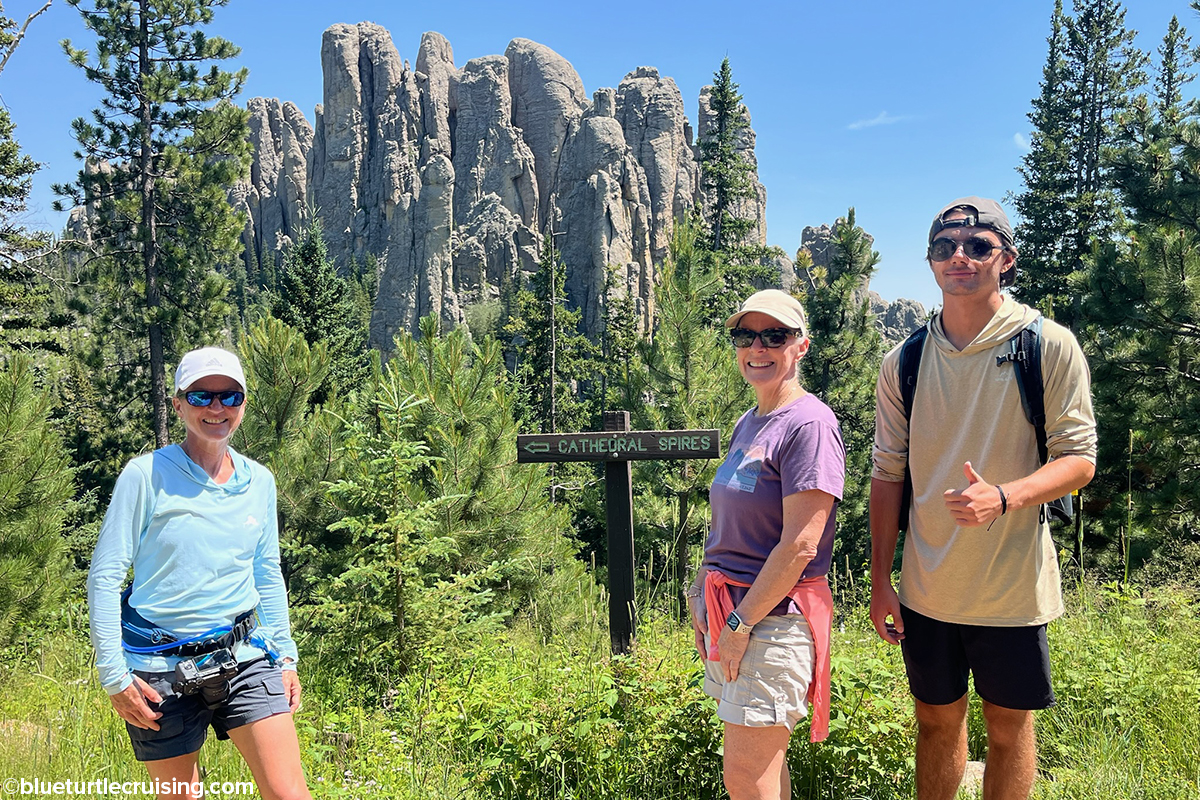
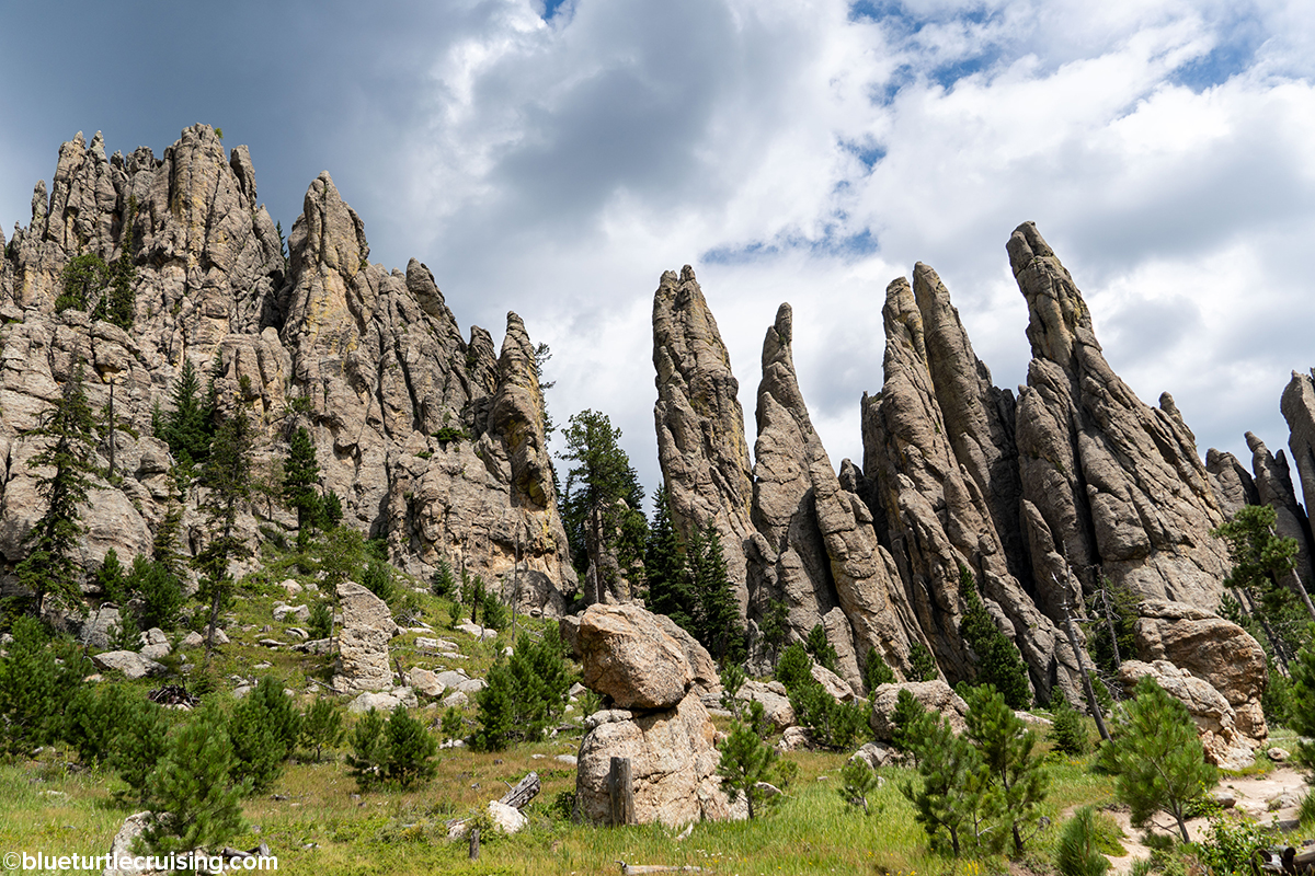
Cathedral Spires
Cathedral Spires are rock formations along Needles Highway that were shaped millions of years ago, eventually eroding into granite pillars. There is a parking area and trailhead for the Spires that involves a steep climb to get to the spires area. You can also catch the trail from the #4 trail as we did many times. The climb to see it is worth the effort!

Sunday Gulch
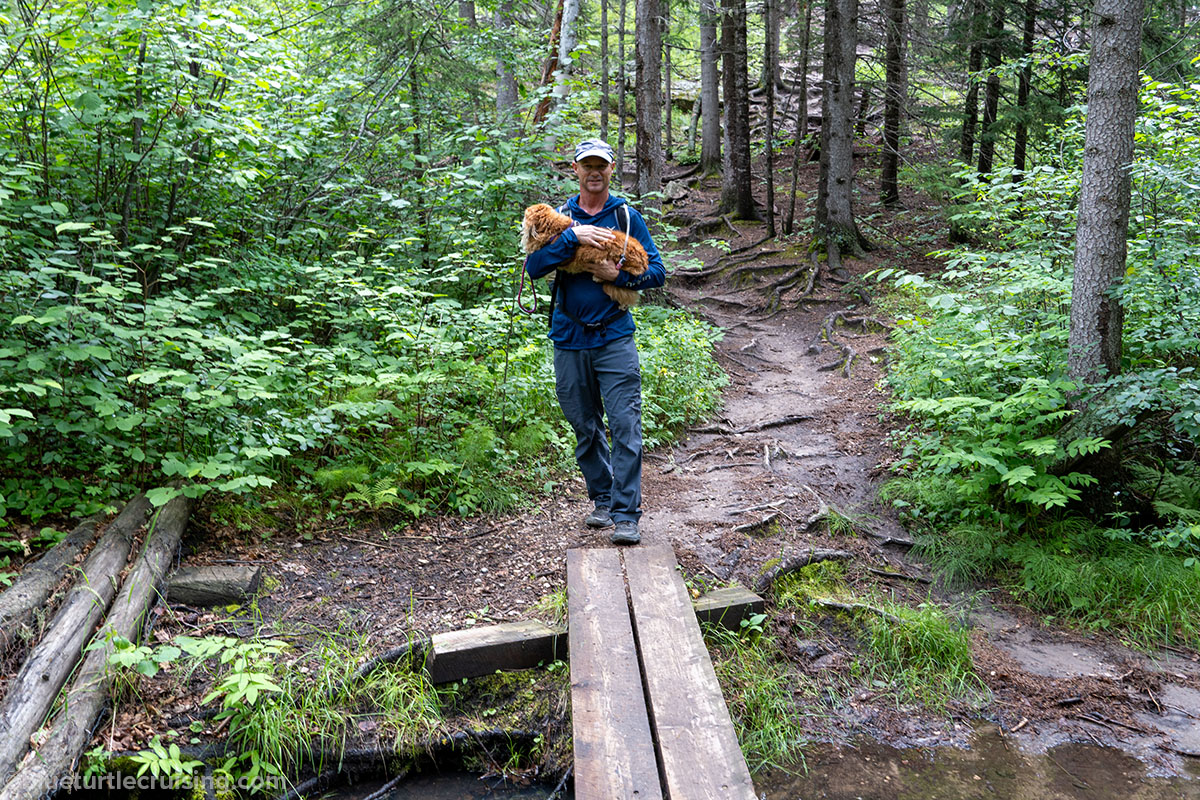
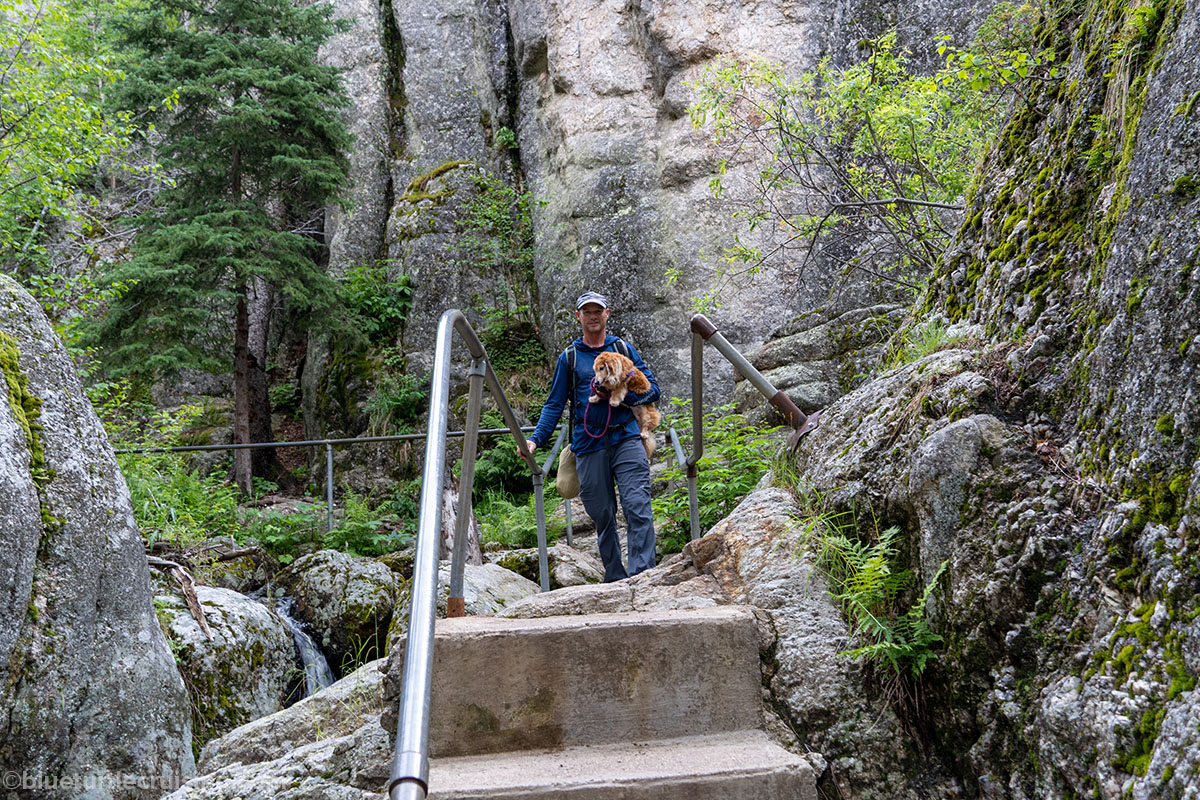
Sunday Gulch is another popular hike that starts at Sylvan Lake. It’s a 4 mile loop that starts with scrambling over large rocks near streams and waterfalls. There are rails to grab onto that are definitely needed as these rocks are very slippery. It’s not surprising that many rescues happen at the part of the trail. Once you scramble down the boulders the trail takes you down through river/stream beds and spruce tree habitat. Eventually you have to climb back up and are treated with fantastic view of the Black Hills and rock formations. The first time Randy and I did this trail, we didn’t believe the bouldering would be that hard (especially after Little Devils Tower) so we decided to take Sophie thinking it would be a nice 4 mile easy hike and she’d be able to walk a mile or so of it. We were totally wrong! Randy was a champ in clutching Sophie while scaling the slippery rocks. Thankfully, we brought a carrying harness with us and strapped her to his chest after 2 miles.


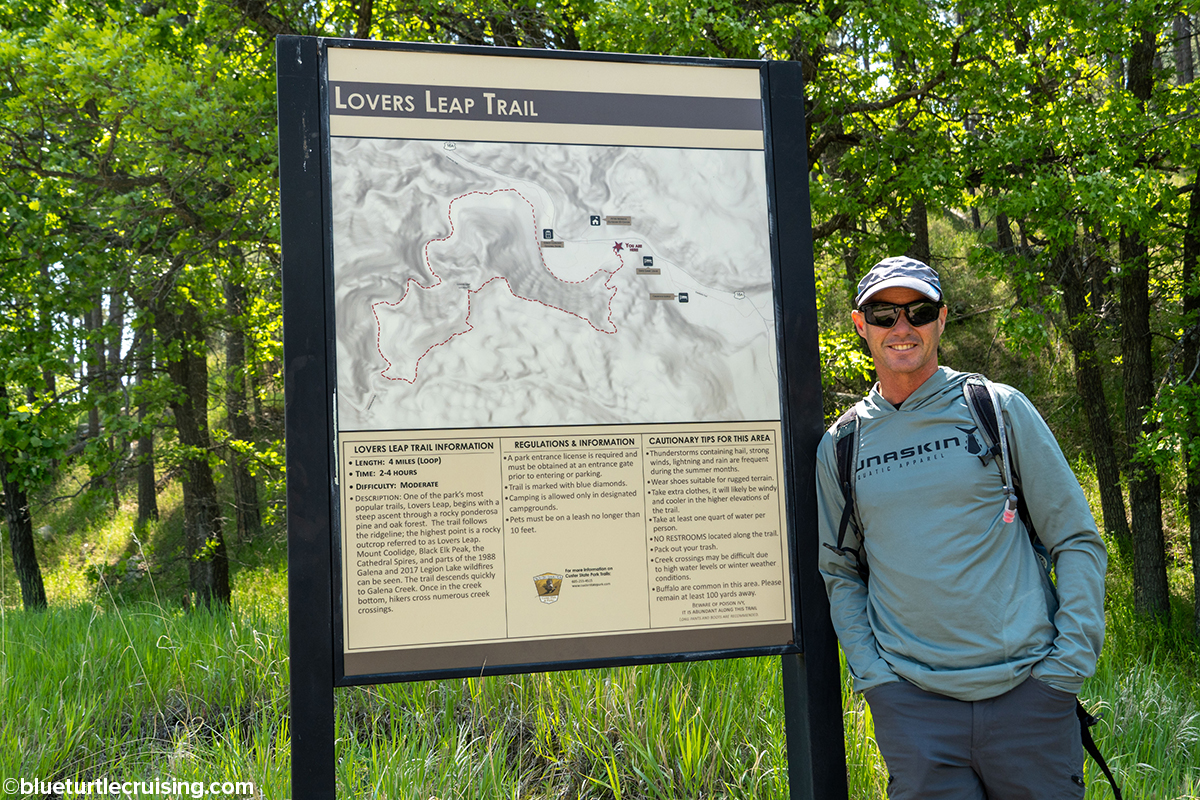
Lover’s Leap
According to local folklore Lovers Leap was named after two Native American lovers jumped to their deaths from the cliff summit for reasons unknown. It’s a moderate 4 mile loop that starts with a climb through ponderosa pine and oak forest and following the ridge line, the highest point being Lovers Leap. The trail descends to Galena Creek and offers numerous creek crossings for hikers.


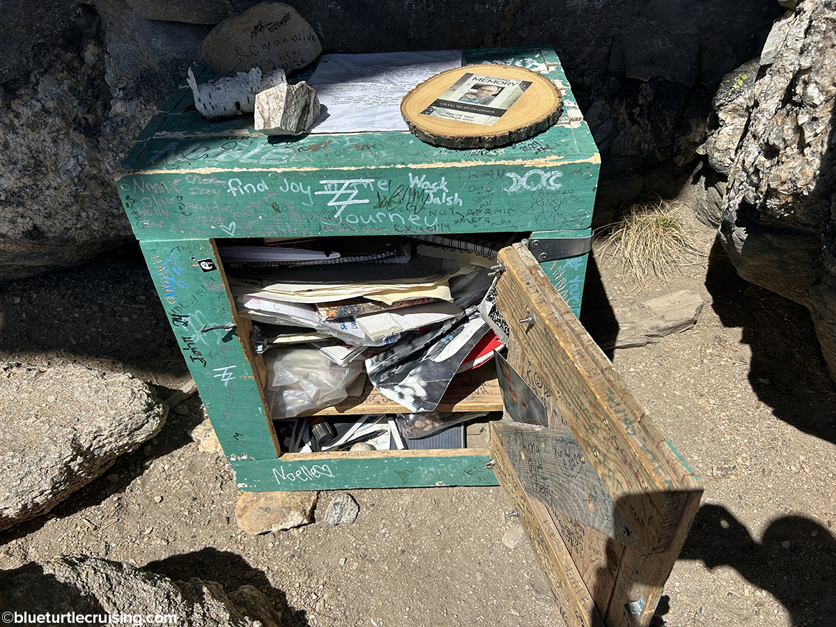
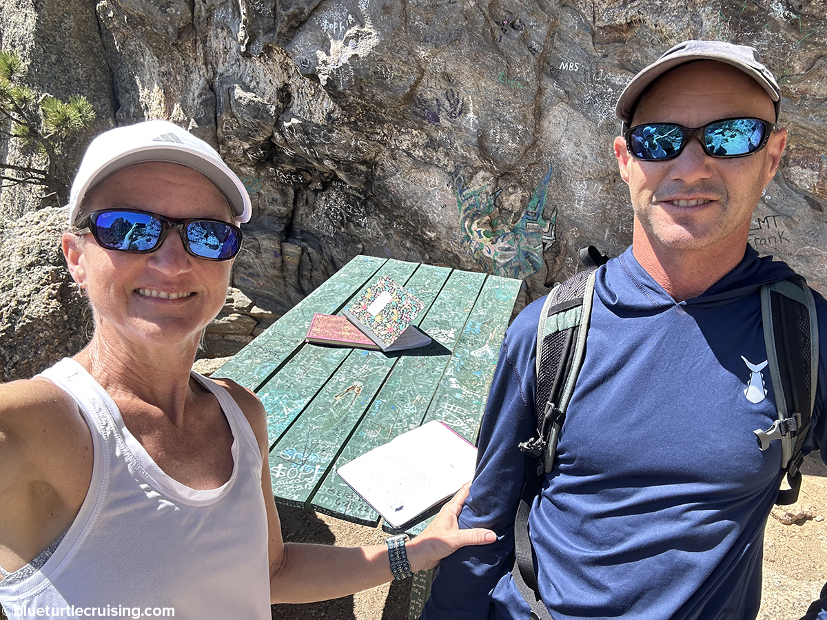
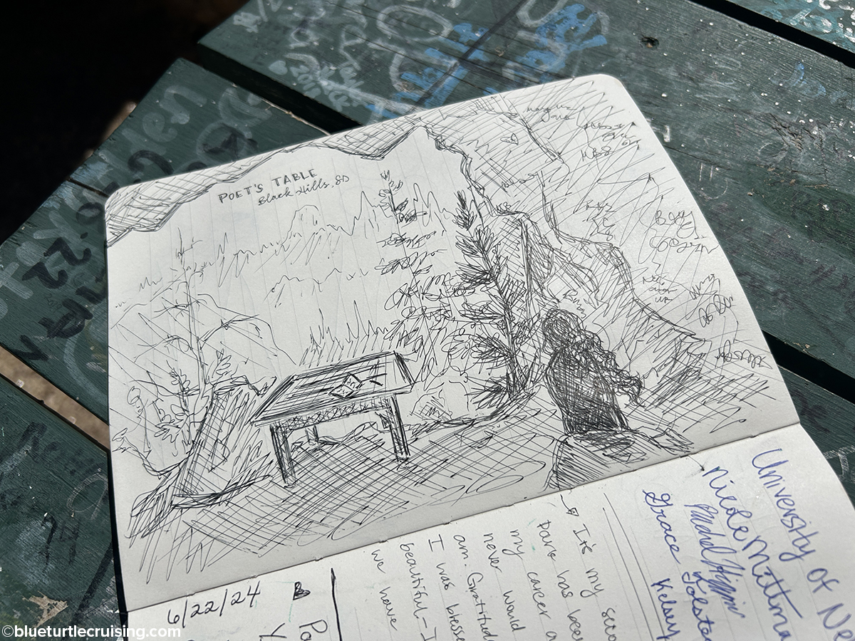
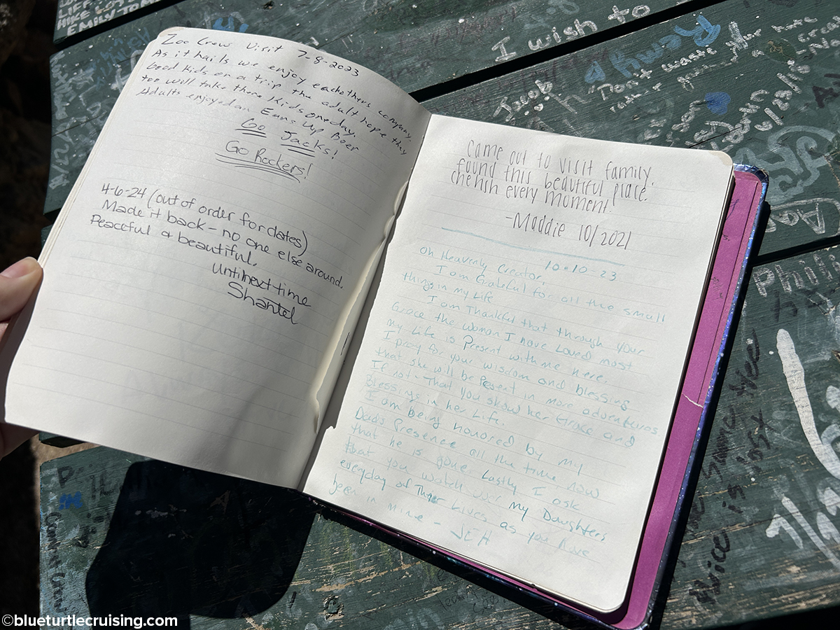
Poet’s Table
Poet’s Table is a secret little local spot nestled among the granite peaks in Custer State Park. It’s off of the #4 trail but there isn’t a trail map so most find it by trial and error. In the 1960’s a table, chair and bookshelf was placed there by the “Vagabond Poet”, John Raeck. The spot was meant for creative writing and contemplation, and hikers began leaving their own writings in notebooks Raeck placed there. The original table was destroyed by vandalism in 2018, but the park has replaced it. You can search online to try to find directions but they are all misleading and vague probably because the locals want to keep it a secret. It took Randy and I three tries one day to find it. We’d scramble up rocky trails with high growth (summer months) only to turn around and come back down and try again until we eventually found it.


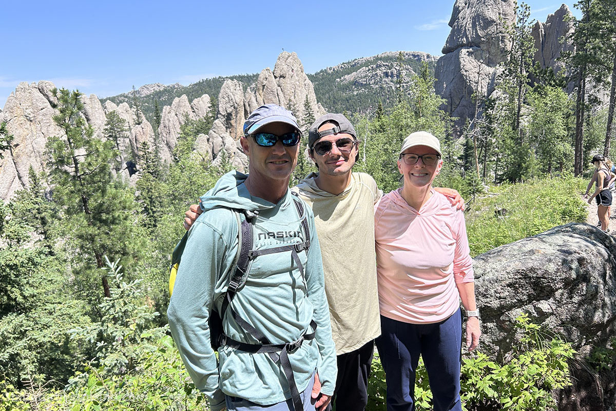
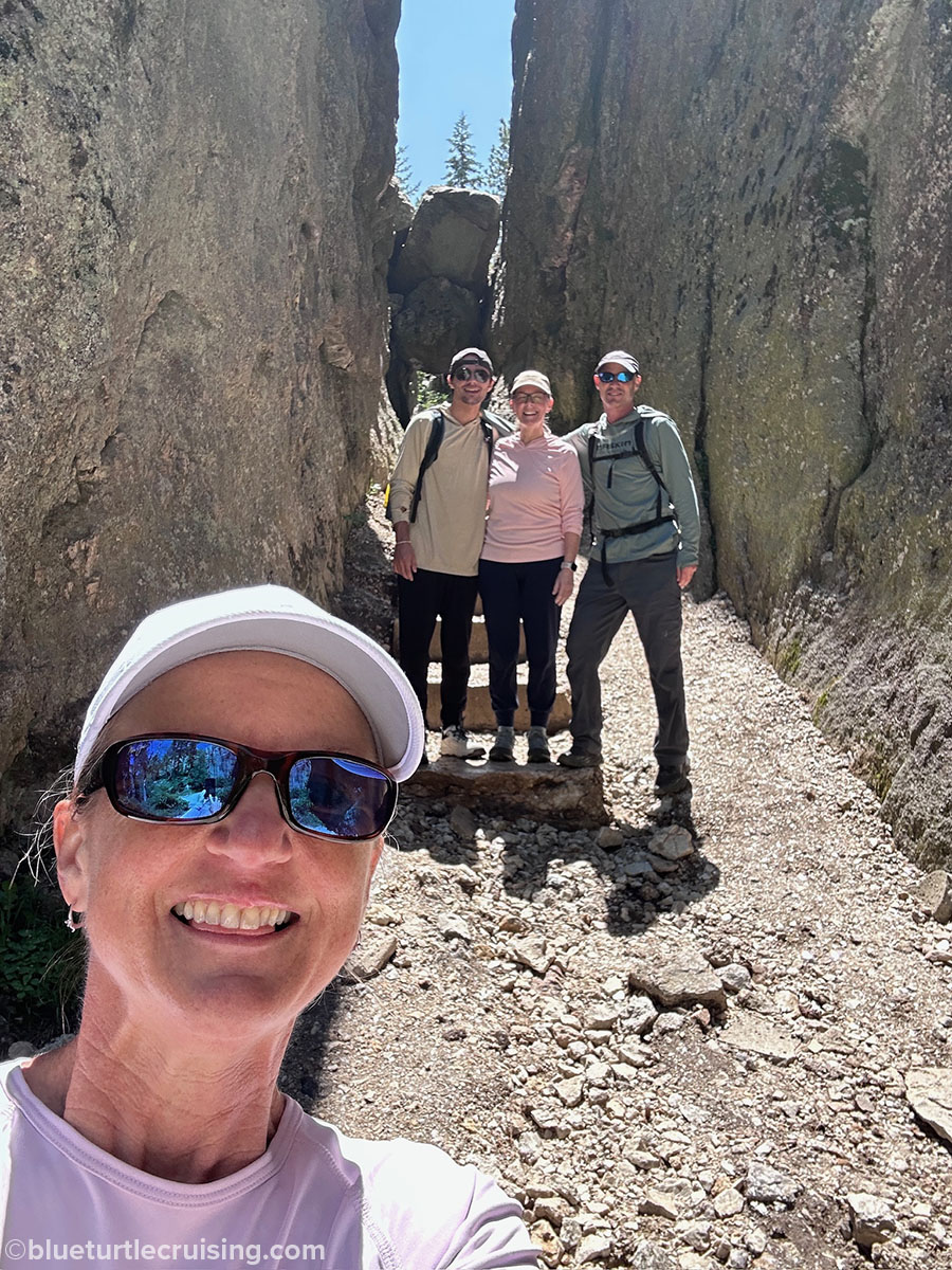
Custer State Park is a gem located in the Black Hills of South Dakota. There’s something for everyone there and we were stoked to have 5 months to explore and hike the park. It was also exciting that we had family visit and hike with us in one of our favorite places.


2 thoughts on “Custer State Park: A Black Hills must-see and do”